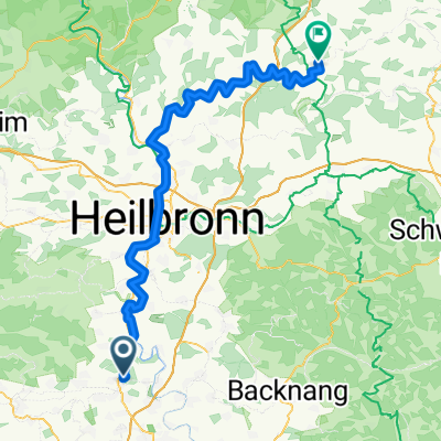
3B-Land-Tour
A cycling route starting in Bietigheim-Bissingen, Baden-Wurttemberg, Germany.
Overview
About this route
Bietigheim 6 Bf6nnigheim 16.0 km
-
The tour starts in Bietigheim at 'Kronenplatz'. Cross the bridge to 'Bfcrgergarten'. After the bridge, turn left and pass under the main road.
-
On the bike path, head up towards and past the gas station. Turn left into 'Grfcnwiesenstraße'. At its end, veer half-left, following the 'Neckartal-Weg', pass the sewage treatment plant, and head towards Besigheim.
-
Pass under the B27, proceed straight onto 'Hauptstraße' and continue through the town. At the end, continue straight and follow B27's course over the Enz river towards Kirchheim.
-
Take the bike/pedestrian path to Kirchheim, following the 'Neckartal-Weg' along 'Hauptstraße' through the town.
-
Continue on 'Heilbronner Straße'; at the town's exit, just before the ramp onto B27, turn right onto a farm road, go under the tracks, and follow along the Neckar river.
-
At Kirchheim's entrance, turn left through the underpass, then half-right uphill into the town centre.
-
Turn left into 'Rathausstraße', cross the square and the pedestrian crossingon the left, turn left, then the next right into 'Talstraße' and continue straight out of town.
-
At the fork in Hohenstein, veer half-right, cross the bridge, then left into 'Kirchwiesenstraße'. Before the bridge, turn right into 'Mühlstraße', then straight along the stream on the uphill bike path.
-
At its end, turn left onto the roadside bike path to Bönnigheim. At the end of the bike path, at the intersection, continue straight into the old town.
Bönnigheim 6 Bietigheim 13.0 km
-
Turn right onto and across the car park, then left into 'Kirchgasse'. Turn left into 'Hauptstraße' and at its end, continue straight, then along 'Erligheimer Straße' (L1107) to Erligheim.
-
Follow L1107 through the town. Just before exiting, turn right into 'Kuhäckerstraße'.
-
In the right curve, turn left onto the farm road, at the T-junction turn left, cross the stream and at the bike trail junction near the farm, go straight.
-
At Löchgau’s entrance near the playground, turn left onto 'Eichenweg', at its end turn right downhill to the main road. On this, turn left and immediately right onto the footpath to cross the stream straight ahead.
-
At the end of 'Löfflerstraße' turn right, leaving town and at the next fork turn left uphill. Follow the farm road straight to L1141. Cross it straight and veer half-right onto the farm road.
-
Straight over the district road to Weißenhof. At the T-junction turn left, next right, at the 4-way intersection go straight, at the forest edge turn left around the bend, then straight to the T-junction. There, turn right towards the hut and at the fork, half-left.
-
At the T-junction turn left onto the main road and on the bike path towards Bietigheim’s town entrance. Turn right downhill along the town’s edge.
-
At the end of the farm road turn left into 'Turmstraße'. At its end turn left into 'Bei der Kelter' street, straight onto 'Schieringerbrunnenstraße', then right downhill onto 'Fräuleinstraße' into the pedestrian zone. On 'Hauptstraße' turn left, back to the tour’s starting point.
- -:--
- Duration
- 29.1 km
- Distance
- 195 m
- Ascent
- 195 m
- Descent
- ---
- Avg. speed
- ---
- Max. altitude
Route quality
Waytypes & surfaces along the route
Waytypes
Quiet road
8.4 km
(29 %)
Track
8.4 km
(29 %)
Surfaces
Paved
27.7 km
(95 %)
Asphalt
26.2 km
(90 %)
Paved (undefined)
1.5 km
(5 %)
Undefined
1.5 km
(5 %)
Continue with Bikemap
Use, edit, or download this cycling route
You would like to ride 3B-Land-Tour or customize it for your own trip? Here is what you can do with this Bikemap route:
Free features
- Save this route as favorite or in collections
- Copy & plan your own version of this route
- Sync your route with Garmin or Wahoo
Premium features
Free trial for 3 days, or one-time payment. More about Bikemap Premium.
- Navigate this route on iOS & Android
- Export a GPX / KML file of this route
- Create your custom printout (try it for free)
- Download this route for offline navigation
Discover more Premium features.
Get Bikemap PremiumFrom our community
Other popular routes starting in Bietigheim-Bissingen
 Bi-Marb-Grossb-Mundelsh-Besigh-Bi
- Distance
- 43.5 km
- Ascent
- 262 m
- Descent
- 261 m
- Location
- Bietigheim-Bissingen, Baden-Wurttemberg, Germany
 3BWeintour
- Distance
- 29.9 km
- Ascent
- 171 m
- Descent
- 171 m
- Location
- Bietigheim-Bissingen, Baden-Wurttemberg, Germany
 Sachsenheim-Horrheim-Vahingen und zurück
- Distance
- 29.6 km
- Ascent
- 200 m
- Descent
- 197 m
- Location
- Bietigheim-Bissingen, Baden-Wurttemberg, Germany
 Bietigheim-Pfeiferhütte- Bietigheim
- Distance
- 25.1 km
- Ascent
- 285 m
- Descent
- 283 m
- Location
- Bietigheim-Bissingen, Baden-Wurttemberg, Germany
 Schulstraße 8, Bietigheim-Bissingen nach Schulstraße 15, Bietigheim-Bissingen
- Distance
- 54.2 km
- Ascent
- 452 m
- Descent
- 455 m
- Location
- Bietigheim-Bissingen, Baden-Wurttemberg, Germany
 Jagst Kocher 1
- Distance
- 85.7 km
- Ascent
- 881 m
- Descent
- 829 m
- Location
- Bietigheim-Bissingen, Baden-Wurttemberg, Germany
 Goethestraße, Sachsenheim nach Wobachstraße, Bietigheim-Bissingen
- Distance
- 6.1 km
- Ascent
- 27 m
- Descent
- 85 m
- Location
- Bietigheim-Bissingen, Baden-Wurttemberg, Germany
 vom Neckar durch den Kraichgau zum Rhein.
- Distance
- 103.4 km
- Ascent
- 810 m
- Descent
- 846 m
- Location
- Bietigheim-Bissingen, Baden-Wurttemberg, Germany
Open it in the app


