

Genusstour Ohlstadt - Kloster Benediktbeuren
A cycling route starting in Ohlstadt, Bavaria, Germany.
Overview
About this route
leichte halbtages Fahrradtour ohne nennenswerte Steigungen
schönster Streckenabschnitt: entlang der Loisach zwischen Kochel und Benediktbeuren: tollen Gebirgsblick auf Jochberg, Herzogstand und Heimgarten (Man hat den Eindruck als wär man in "Kanada" ;-)
Einkehrmöglichkeiten mit Biergarten in Schwaiganger und Kloster Benediktbeuren.
Der Streckenabschnitt entlang dem Triftkanal (noch ein Relikt der Flößerzeit) nach Großweil kann nach längerem Regen sehr schlammig sein.
Zwischen Großweil und Schwaiganger gut ausgebauter Fahrradweg entlang der vielbefahrenen Staatsstraße.
- -:--
- Duration
- 45.1 km
- Distance
- 229 m
- Ascent
- 229 m
- Descent
- ---
- Avg. speed
- ---
- Max. altitude
Route highlights
Points of interest along the route
Point of interest after 3.9 km
Point of interest after 5.8 km
Einkehrmöglichkeit: Gasthof Schwaiganger mit Biergarten
Point of interest after 23.6 km
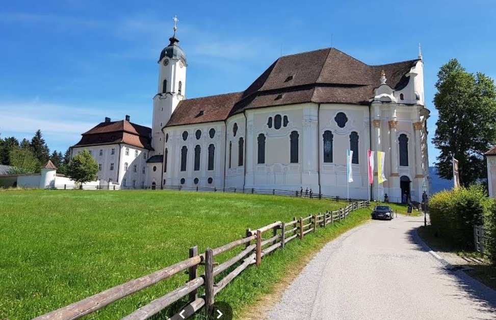
Einkehrmöglichkeit Klosterwirtschaft mit Biergarten
Point of interest after 24.5 km
Eisdiele
Continue with Bikemap
Use, edit, or download this cycling route
You would like to ride Genusstour Ohlstadt - Kloster Benediktbeuren or customize it for your own trip? Here is what you can do with this Bikemap route:
Free features
- Save this route as favorite or in collections
- Copy & plan your own version of this route
- Sync your route with Garmin or Wahoo
Premium features
Free trial for 3 days, or one-time payment. More about Bikemap Premium.
- Navigate this route on iOS & Android
- Export a GPX / KML file of this route
- Create your custom printout (try it for free)
- Download this route for offline navigation
Discover more Premium features.
Get Bikemap PremiumFrom our community
Other popular routes starting in Ohlstadt
 Pässlich 01 - Alternativroute
- Distance
- 122.4 km
- Ascent
- 1,651 m
- Descent
- 1,498 m
- Location
- Ohlstadt, Bavaria, Germany
 From Ohlstadt to Fussen
- Distance
- 68.8 km
- Ascent
- 1,004 m
- Descent
- 881 m
- Location
- Ohlstadt, Bavaria, Germany
 Von Ohlstadt übers Katzental nach Partenkirchen
- Distance
- 42.7 km
- Ascent
- 358 m
- Descent
- 358 m
- Location
- Ohlstadt, Bavaria, Germany
 Murnauer Moosrunde
- Distance
- 30.7 km
- Ascent
- 132 m
- Descent
- 132 m
- Location
- Ohlstadt, Bavaria, Germany
 Ohlstadt-Hohenkasten-Ohlstadt
- Distance
- 59.5 km
- Ascent
- 412 m
- Descent
- 409 m
- Location
- Ohlstadt, Bavaria, Germany
 Ohlstad via Eschelaine
- Distance
- 17.9 km
- Ascent
- 1,612 m
- Descent
- 882 m
- Location
- Ohlstadt, Bavaria, Germany
 MTB Walchensee/Ohlstadt
- Distance
- 50.2 km
- Ascent
- 893 m
- Descent
- 896 m
- Location
- Ohlstadt, Bavaria, Germany
 Genusstour Ohlstadt - Kloster Benediktbeuren
- Distance
- 45.1 km
- Ascent
- 229 m
- Descent
- 229 m
- Location
- Ohlstadt, Bavaria, Germany
Open it in the app