Kráľ kopcov
A cycling route starting in Zlaté Moravce, Nitra Region, Slovakia.
Overview
About this route
Route for cross or mountain bikes.
The route starts gently and recreationally in Zlaté Moravce. After about 6500 meters in Machulince, a challenging climb begins with an elevation of 356 m over just under 4200 meters, where riders typically pedal standing up at a maximum speed of 12 km/h.
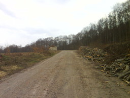
At approximately 12,200 meters, you reach the highest point of the route at 673 meters above sea level. From there, it is an 8 km descent alongside the Calex recreational center down to Olichov.
- -:--
- Duration
- 30.9 km
- Distance
- 532 m
- Ascent
- 534 m
- Descent
- ---
- Avg. speed
- ---
- Max. altitude
Route quality
Waytypes & surfaces along the route
Waytypes
Track
13.9 km
(45 %)
Road
11.4 km
(37 %)
Surfaces
Paved
10.8 km
(35 %)
Unpaved
9.3 km
(30 %)
Asphalt
10.8 km
(35 %)
Gravel
9.3 km
(30 %)
Undefined
10.8 km
(35 %)
Route highlights
Points of interest along the route

Photo after 8.6 km

Photo after 10.8 km

Photo after 11.2 km

Photo after 12.4 km

Photo after 19.3 km

Photo after 27.5 km
Continue with Bikemap
Use, edit, or download this cycling route
You would like to ride Kráľ kopcov or customize it for your own trip? Here is what you can do with this Bikemap route:
Free features
- Save this route as favorite or in collections
- Copy & plan your own version of this route
- Sync your route with Garmin or Wahoo
Premium features
Free trial for 3 days, or one-time payment. More about Bikemap Premium.
- Navigate this route on iOS & Android
- Export a GPX / KML file of this route
- Create your custom printout (try it for free)
- Download this route for offline navigation
Discover more Premium features.
Get Bikemap PremiumFrom our community
Other popular routes starting in Zlaté Moravce
 SpartaBikeTrip - 2015 / 4447 km
- Distance
- 4,377 km
- Ascent
- 4,353 m
- Descent
- 4,350 m
- Location
- Zlaté Moravce, Nitra Region, Slovakia
 Odstrel v Kameňolome pod Benátom
- Distance
- 27.5 km
- Ascent
- 173 m
- Descent
- 135 m
- Location
- Zlaté Moravce, Nitra Region, Slovakia
 Gýmeš
Gýmeš- Distance
- 53.8 km
- Ascent
- 573 m
- Descent
- 573 m
- Location
- Zlaté Moravce, Nitra Region, Slovakia
 Tribeč
- Distance
- 18.4 km
- Ascent
- 561 m
- Descent
- 557 m
- Location
- Zlaté Moravce, Nitra Region, Slovakia
 Jazvinská jaskyňa_Píla
- Distance
- 97.4 km
- Ascent
- 1,075 m
- Descent
- 1,073 m
- Location
- Zlaté Moravce, Nitra Region, Slovakia
 Zobor
Zobor- Distance
- 79 km
- Ascent
- 665 m
- Descent
- 666 m
- Location
- Zlaté Moravce, Nitra Region, Slovakia
 čierny hrad pri zlatne
- Distance
- 41.3 km
- Ascent
- 386 m
- Descent
- 384 m
- Location
- Zlaté Moravce, Nitra Region, Slovakia
 Malá Lehota
- Distance
- 71 km
- Ascent
- 539 m
- Descent
- 539 m
- Location
- Zlaté Moravce, Nitra Region, Slovakia
Open it in the app


