

Von der Elbe an die Spree
A cycling route starting in Bad Schandau, Saxony, Germany.
Overview
About this route
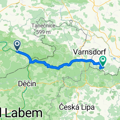
Tagestour mit welligem Profil und einigen Anstiegen. Anreise mit der Bahn bis Bad Schandau. Vom Bahnhof auf den Kirnitzschradweg und diesem bis zur Quelle östlich von Krasna Lipa folgen. Ab da weiter über Studanka und Seifhennersdorf nach Neugersdorf. Auf dem Spreeradweg dann zum Ziel in Taubenheim. Alternativ kann auch in der Gegenrichtung geradelt werden.
- 5 h 17 min
- Duration
- 73.3 km
- Distance
- 1,534 m
- Ascent
- 1,374 m
- Descent
- 13.9 km/h
- Avg. speed
- 515 m
- Max. altitude

Route quality
Waytypes & surfaces along the route
Waytypes
Track
26.4 km
(36 %)
Quiet road
20.5 km
(28 %)
Surfaces
Paved
40.3 km
(55 %)
Unpaved
13.9 km
(19 %)
Asphalt
36.6 km
(50 %)
Gravel
11.7 km
(16 %)
Continue with Bikemap
Use, edit, or download this cycling route
You would like to ride Von der Elbe an die Spree or customize it for your own trip? Here is what you can do with this Bikemap route:
Free features
- Save this route as favorite or in collections
- Copy & plan your own version of this route
- Sync your route with Garmin or Wahoo
Premium features
Free trial for 3 days, or one-time payment. More about Bikemap Premium.
- Navigate this route on iOS & Android
- Export a GPX / KML file of this route
- Create your custom printout (try it for free)
- Download this route for offline navigation
Discover more Premium features.
Get Bikemap PremiumFrom our community
Other popular routes starting in Bad Schandau
 Bad Schandau - Johnsdorf
- Distance
- 52.6 km
- Ascent
- 945 m
- Descent
- 657 m
- Location
- Bad Schandau, Saxony, Germany
 Elberadweg
- Distance
- 763.1 km
- Ascent
- 150 m
- Descent
- 287 m
- Location
- Bad Schandau, Saxony, Germany
 Bad Schandau nach Dresden
- Distance
- 44.7 km
- Ascent
- 235 m
- Descent
- 337 m
- Location
- Bad Schandau, Saxony, Germany
 unlöschbare MTB-Tour
- Distance
- 68.2 km
- Ascent
- 1,428 m
- Descent
- 1,420 m
- Location
- Bad Schandau, Saxony, Germany
 Rechts und links an der Elbe
- Distance
- 28.5 km
- Ascent
- 79 m
- Descent
- 75 m
- Location
- Bad Schandau, Saxony, Germany
 Elberadweg
- Distance
- 855.3 km
- Ascent
- 186 m
- Descent
- 327 m
- Location
- Bad Schandau, Saxony, Germany
 Elbet
Elbet- Distance
- 60.2 km
- Ascent
- 923 m
- Descent
- 932 m
- Location
- Bad Schandau, Saxony, Germany
 Elberadweg
- Distance
- 773.3 km
- Ascent
- 237 m
- Descent
- 394 m
- Location
- Bad Schandau, Saxony, Germany
Open it in the app