R4K PC2012 dag 3 Groep A
- 125.7 km
- 2,408 m
- 2,409 m
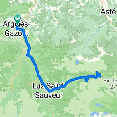
- Argelès-Gazost, Occitanie, France
A cycling route starting in Argelès-Gazost, Occitanie, France.
Overview
created this 13 years ago
Route quality
Access road
0.5 km
(1 %)
Undefined
46 km
(99 %)
Paved
45 km
(97 %)
Asphalt
45 km
(97 %)
Undefined
1.4 km
(3 %)
Route highlights
http://www.cyclingcols.com/profiles/SoulorE.gif
Continue with Bikemap
You would like to ride V12 Cols de Soulor i Aubisque or customize it for your own trip? Here is what you can do with this Bikemap route:
Free trial for 3 days, or one-time payment. More about Bikemap Premium.
Discover more Premium features.
Get Bikemap PremiumFrom our community
Open it in the app