

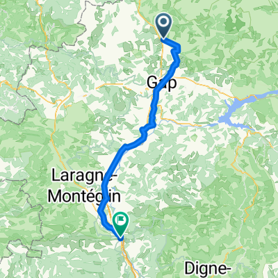
COL DU NOYER (Saint-Bonnet-en-Champsaur)
A cycling route starting in Saint-Bonnet-en-Champsaur, Provence-Alpes-Côte d'Azur Region, France.
Overview
About this route
El col de Noyer es un paso de montaña que separa los valles de Champsaur y la región de Dévoluy, en el departamento de los Altos Alpes. A una altitud de 1664 m, se encuentra entre el Pic Ponsin y la Tête du Tourneau. Atraviesa la cresta oriental del impresionante macizo calcáreo de Dévoluy.
- 1 h 26 min
- Duration
- 13.3 km
- Distance
- 961 m
- Ascent
- 262 m
- Descent
- 9.3 km/h
- Avg. speed
- 1,675 m
- Max. altitude

Route photos
\"")
Route quality
Waytypes & surfaces along the route
Waytypes
Road
12.1 km
(91 %)
Track
1.2 km
(9 %)
Surfaces
Paved
0.5 km
(4 %)
Asphalt
0.5 km
(4 %)
Undefined
12.7 km
(96 %)
Continue with Bikemap
Use, edit, or download this cycling route
You would like to ride COL DU NOYER (Saint-Bonnet-en-Champsaur) or customize it for your own trip? Here is what you can do with this Bikemap route:
Free features
- Save this route as favorite or in collections
- Copy & plan your own version of this route
- Sync your route with Garmin or Wahoo
Premium features
Free trial for 3 days, or one-time payment. More about Bikemap Premium.
- Navigate this route on iOS & Android
- Export a GPX / KML file of this route
- Create your custom printout (try it for free)
- Download this route for offline navigation
Discover more Premium features.
Get Bikemap PremiumFrom our community
Other popular routes starting in Saint-Bonnet-en-Champsaur
 cLo Alpes Tour de Gioberney
- Distance
- 109.5 km
- Ascent
- 1,752 m
- Descent
- 1,752 m
- Location
- Saint-Bonnet-en-Champsaur, Provence-Alpes-Côte d'Azur Region, France
 Chemin du Ga, Saint-Bonnet-en-Champsaur nach Avenue de la Libération, Sisteron
- Distance
- 75.6 km
- Ascent
- 804 m
- Descent
- 1,299 m
- Location
- Saint-Bonnet-en-Champsaur, Provence-Alpes-Côte d'Azur Region, France
 Saint Bonnet en Champsaur - Gap - Sisteron
- Distance
- 75.6 km
- Ascent
- 852 m
- Descent
- 1,372 m
- Location
- Saint-Bonnet-en-Champsaur, Provence-Alpes-Côte d'Azur Region, France
 Jumelage 2015 - étape 3
- Distance
- 156.9 km
- Ascent
- 2,224 m
- Descent
- 2,514 m
- Location
- Saint-Bonnet-en-Champsaur, Provence-Alpes-Côte d'Azur Region, France
 Stage 19 of 26 Corps - Voiron 113km
- Distance
- 113.6 km
- Ascent
- 1,035 m
- Descent
- 1,446 m
- Location
- Saint-Bonnet-en-Champsaur, Provence-Alpes-Côte d'Azur Region, France
 22-12
22-12- Distance
- 78.8 km
- Ascent
- 1,543 m
- Descent
- 2,331 m
- Location
- Saint-Bonnet-en-Champsaur, Provence-Alpes-Côte d'Azur Region, France
 Grenoble Avignon Gap
- Distance
- 580.5 km
- Ascent
- 4,151 m
- Descent
- 4,375 m
- Location
- Saint-Bonnet-en-Champsaur, Provence-Alpes-Côte d'Azur Region, France
 Col du Noyer
- Distance
- 87.2 km
- Ascent
- 1,933 m
- Descent
- 1,933 m
- Location
- Saint-Bonnet-en-Champsaur, Provence-Alpes-Côte d'Azur Region, France
Open it in the app