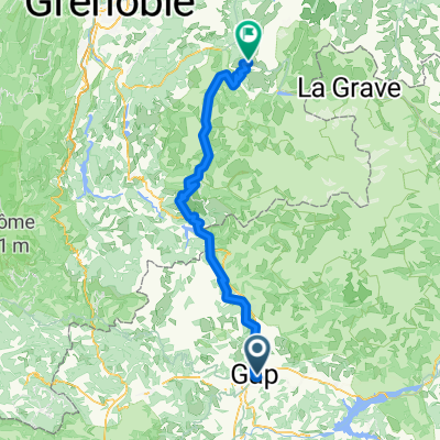
Provence Grand Tour
- 324.7 km
- 4,299 m
- 4,826 m
- Gap, Provence-Alpes-Côte d'Azur Region, France
A cycling route starting in Gap, Provence-Alpes-Côte d'Azur Region, France.
Overview
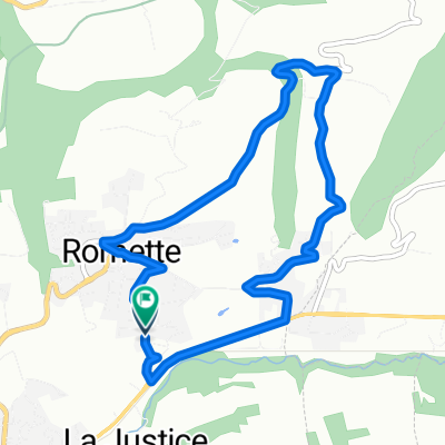
Col Bayard, also known as Gap, is a well-known climb in the Southern Alps region of France. Located near the town of Gap, in the Hautes-Alpes department, this mountain pass rises to an altitude of 1,246 meters above sea level. It is distinguished by its spectacular landscapes, including panoramic views of rugged mountains and green valleys, making it a popular destination for both tourists and cyclists.
created this 1 year ago
\"")
Route quality
Quiet road
0.8 km
(9 %)
Access road
0.2 km
(2 %)
Paved
8.4 km
(95 %)
Unpaved
0.1 km
(1 %)
Asphalt
8.4 km
(95 %)
Ground
0.1 km
(1 %)
Undefined
0.4 km
(4 %)
Continue with Bikemap
You would like to ride COL BAYARD (por Gap) or customize it for your own trip? Here is what you can do with this Bikemap route:
Free trial for 3 days, or one-time payment. More about Bikemap Premium.
Discover more Premium features.
Get Bikemap PremiumFrom our community
Open it in the app