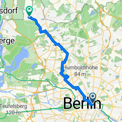
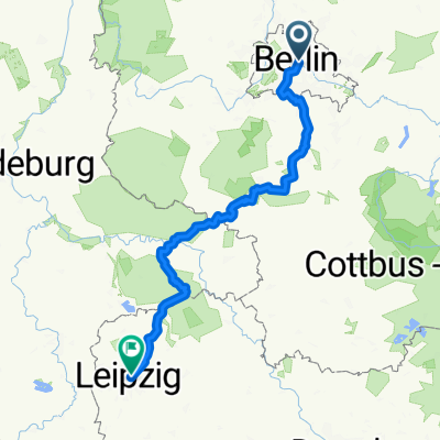
prag
A cycling route starting in Mitte, State of Berlin, Germany.
Overview
About this route
xxx
- -:--
- Duration
- 367.5 km
- Distance
- 1,047 m
- Ascent
- 897 m
- Descent
- ---
- Avg. speed
- ---
- Max. altitude
Route quality
Waytypes & surfaces along the route
Waytypes
Quiet road
44.1 km
(12 %)
Road
40.4 km
(11 %)
Surfaces
Paved
272 km
(74 %)
Unpaved
3.7 km
(1 %)
Asphalt
264.6 km
(72 %)
Paved (undefined)
3.7 km
(1 %)
Continue with Bikemap
Use, edit, or download this cycling route
You would like to ride prag or customize it for your own trip? Here is what you can do with this Bikemap route:
Free features
- Save this route as favorite or in collections
- Copy & plan your own version of this route
- Split it into stages to create a multi-day tour
- Sync your route with Garmin or Wahoo
Premium features
Free trial for 3 days, or one-time payment. More about Bikemap Premium.
- Navigate this route on iOS & Android
- Export a GPX / KML file of this route
- Create your custom printout (try it for free)
- Download this route for offline navigation
Discover more Premium features.
Get Bikemap PremiumFrom our community
Other popular routes starting in Mitte
BerFi - Von Berlin zum Fichtelberg- Distance
- 314.9 km
- Ascent
- 1,239 m
- Descent
- 717 m
- Location
- Mitte, State of Berlin, Germany
Route von Berlin- Distance
- 21.6 km
- Ascent
- 62 m
- Descent
- 50 m
- Location
- Mitte, State of Berlin, Germany
Mitte Birkenwerder Runde- Distance
- 75.4 km
- Ascent
- 103 m
- Descent
- 102 m
- Location
- Mitte, State of Berlin, Germany
So relaxt 🚴♂️🚴🏻♀️- Distance
- 10.6 km
- Ascent
- 146 m
- Descent
- 154 m
- Location
- Mitte, State of Berlin, Germany
Englisches Viertel, Stegeweg nach Hause- Distance
- 21.8 km
- Ascent
- 84 m
- Descent
- 71 m
- Location
- Mitte, State of Berlin, Germany
prag- Distance
- 367.5 km
- Ascent
- 1,047 m
- Descent
- 897 m
- Location
- Mitte, State of Berlin, Germany
Jüdenstraße, Berlin nach Pufendorfstraße, Berlin- Distance
- 3.9 km
- Ascent
- 12 m
- Descent
- 10 m
- Location
- Mitte, State of Berlin, Germany
Karl-Liebknecht-Straße nach Rackwitzer Straße- Distance
- 237.6 km
- Ascent
- 875 m
- Descent
- 808 m
- Location
- Mitte, State of Berlin, Germany
Open it in the app


