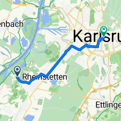
Rundfahrt > Rheinstetten > Baden - Baden - Fremersberg durch das badische Rebland
A cycling route starting in Rheinstetten, Baden-Wurttemberg, Germany.
Overview
About this route
<ul>
<li><strong><em>A road bike route of the RadSportSenioren Rheinstetten</em></strong></li>
<li><strong><em>In spring, it's almost a must for every cyclist. The tour through the Rebland.</em></strong></li>
<li><strong><em>The well-kept front gardens of the wine-growing communities of Varnhalt-Umweg-Steinbach-Neuweier-Eisental-Affental-Bühlertal are all in full bloom. Together with the flowering trees, the fresh juicy green is a feast for the eyes. The view into the Rhine valley is simply magnificent.</em></strong></li>
<li><strong><em>ridden on Easter Saturday 11.04.2009; Sun 23 degrees</em></strong></li>
<li><strong><em>Martin - Günther - Jürgen</em></strong></li>
<li><strong><em>106Km; 600Hm; Average 25Km/h</em></strong></li>
</ul>
<p><strong><em></em></strong></p>
<p> </p>
Translated, show original (German)- -:--
- Duration
- 106.2 km
- Distance
- 563 m
- Ascent
- 565 m
- Descent
- ---
- Avg. speed
- 318 m
- Max. altitude
Route quality
Waytypes & surfaces along the route
Waytypes
Road
24.4 km
(23 %)
Track
21.2 km
(20 %)
Surfaces
Paved
89.2 km
(84 %)
Unpaved
9.6 km
(9 %)
Asphalt
86 km
(81 %)
Unpaved (undefined)
4.2 km
(4 %)
Continue with Bikemap
Use, edit, or download this cycling route
You would like to ride Rundfahrt > Rheinstetten > Baden - Baden - Fremersberg durch das badische Rebland or customize it for your own trip? Here is what you can do with this Bikemap route:
Free features
- Save this route as favorite or in collections
- Copy & plan your own version of this route
- Split it into stages to create a multi-day tour
- Sync your route with Garmin or Wahoo
Premium features
Free trial for 3 days, or one-time payment. More about Bikemap Premium.
- Navigate this route on iOS & Android
- Export a GPX / KML file of this route
- Create your custom printout (try it for free)
- Download this route for offline navigation
Discover more Premium features.
Get Bikemap PremiumFrom our community
Other popular routes starting in Rheinstetten
- Von Rheinstetten zum Campus Nord des KIT
- Distance
- 20.6 km
- Ascent
- 35 m
- Descent
- 37 m
- Location
- Rheinstetten, Baden-Wurttemberg, Germany
- Radwallfahrt zur St. Annakapelle in Burrweiler mit Einkehrschwung im höchst gelegenen Weingut der Pfalz.
- Distance
- 110.6 km
- Ascent
- 464 m
- Descent
- 464 m
- Location
- Rheinstetten, Baden-Wurttemberg, Germany
- durch das Murgtal nach Bermersbach, die Rote Lache über den Scherrhof nach Baden-Baden, Balg, Haueneberstein, Kuppenheim und Muggensturm nach Malsch und zurück
- Distance
- 98.7 km
- Ascent
- 678 m
- Descent
- 686 m
- Location
- Rheinstetten, Baden-Wurttemberg, Germany
- RR -Verkehrsarme " Fünf Täler Rundtour" - Rheintal, Albtal, Eyachtal, Enztal & Murgtal.
- Distance
- 104.7 km
- Ascent
- 1,027 m
- Descent
- 1,029 m
- Location
- Rheinstetten, Baden-Wurttemberg, Germany
- Rheinroute
- Distance
- 80.5 km
- Ascent
- 122 m
- Descent
- 123 m
- Location
- Rheinstetten, Baden-Wurttemberg, Germany
- Karlsruhe Heidelberg
- Distance
- 87.4 km
- Ascent
- 81 m
- Descent
- 85 m
- Location
- Rheinstetten, Baden-Wurttemberg, Germany
- Rund um die badische Residenz.
- Distance
- 64.9 km
- Ascent
- 161 m
- Descent
- 166 m
- Location
- Rheinstetten, Baden-Wurttemberg, Germany
- Frankreichrunde
- Distance
- 70.8 km
- Ascent
- 64 m
- Descent
- 66 m
- Location
- Rheinstetten, Baden-Wurttemberg, Germany
Open it in the app