

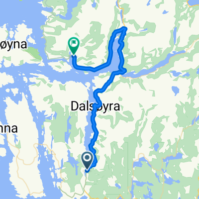
047: Rutledal– Slovag (DEVELOPED)
A cycling route starting in Eivindvik, Sogn og Fjordane, Norway.
Overview
About this route
- 3 h 40 min
- Duration
- 63.2 km
- Distance
- 1,431 m
- Ascent
- 1,428 m
- Descent
- 17.2 km/h
- Avg. speed
- 161 m
- Max. altitude

Route quality
Waytypes & surfaces along the route
Waytypes
Road
19 km
(30 %)
Undefined
44.2 km
(70 %)
Surfaces
Paved
44.2 km
(70 %)
Asphalt
44.2 km
(70 %)
Undefined
19 km
(30 %)
Continue with Bikemap
Use, edit, or download this cycling route
You would like to ride 047: Rutledal– Slovag (DEVELOPED) or customize it for your own trip? Here is what you can do with this Bikemap route:
Free features
- Save this route as favorite or in collections
- Copy & plan your own version of this route
- Sync your route with Garmin or Wahoo
Premium features
Free trial for 3 days, or one-time payment. More about Bikemap Premium.
- Navigate this route on iOS & Android
- Export a GPX / KML file of this route
- Create your custom printout (try it for free)
- Download this route for offline navigation
Discover more Premium features.
Get Bikemap PremiumFrom our community
Other popular routes starting in Eivindvik
 047: Rutledal– Slovag (DEVELOPED)
- Distance
- 63.2 km
- Ascent
- 1,431 m
- Descent
- 1,428 m
- Location
- Eivindvik, Sogn og Fjordane, Norway
 Eivindvik - Eivindvik
- Distance
- 29.8 km
- Ascent
- 702 m
- Descent
- 710 m
- Location
- Eivindvik, Sogn og Fjordane, Norway
 Day 31-Vagen1
- Distance
- 19.7 km
- Ascent
- 384 m
- Descent
- 438 m
- Location
- Eivindvik, Sogn og Fjordane, Norway
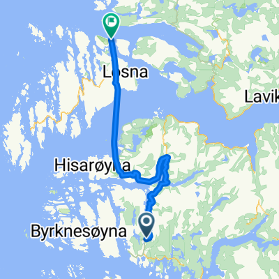
 Eivindvik to Byrknesøy
- Distance
- 56 km
- Ascent
- 1,169 m
- Descent
- 1,163 m
- Location
- Eivindvik, Sogn og Fjordane, Norway
 Eivindvik - Hyllestad
- Distance
- 57.7 km
- Ascent
- 740 m
- Descent
- 754 m
- Location
- Eivindvik, Sogn og Fjordane, Norway
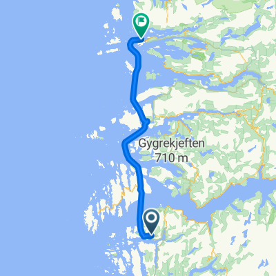 Eivindvik - Florø
- Distance
- 85.3 km
- Ascent
- 43 m
- Descent
- 57 m
- Location
- Eivindvik, Sogn og Fjordane, Norway
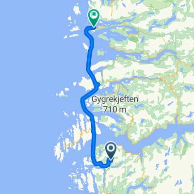 Eivindvik - Florø
- Distance
- 96.9 km
- Ascent
- 228 m
- Descent
- 259 m
- Location
- Eivindvik, Sogn og Fjordane, Norway
 Day 30-Nordgulen2
- Distance
- 43 km
- Ascent
- 942 m
- Descent
- 895 m
- Location
- Eivindvik, Sogn og Fjordane, Norway
Open it in the app