

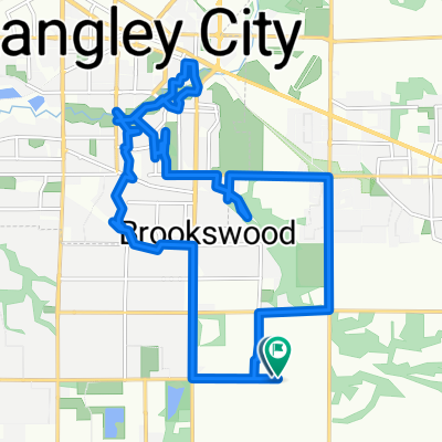
Campbell Valley Park - Pacific Border Crossing
A cycling route starting in Township of Langley, British Columbia, Canada.
Overview
About this route
A decent challenge, although one should be aware that 0 Avenue has no shoulder to ride on and you must be confortable with having trucks driving by you. All routes on map are publice.
Notes:
Bring Water
GPS
Cell Phone
Wind Breaker
Sunglasses<br />
- -:--
- Duration
- 8 km
- Distance
- 114 m
- Ascent
- 177 m
- Descent
- ---
- Avg. speed
- ---
- Max. altitude
Continue with Bikemap
Use, edit, or download this cycling route
You would like to ride Campbell Valley Park - Pacific Border Crossing or customize it for your own trip? Here is what you can do with this Bikemap route:
Free features
- Save this route as favorite or in collections
- Copy & plan your own version of this route
- Sync your route with Garmin or Wahoo
Premium features
Free trial for 3 days, or one-time payment. More about Bikemap Premium.
- Navigate this route on iOS & Android
- Export a GPX / KML file of this route
- Create your custom printout (try it for free)
- Download this route for offline navigation
Discover more Premium features.
Get Bikemap PremiumFrom our community
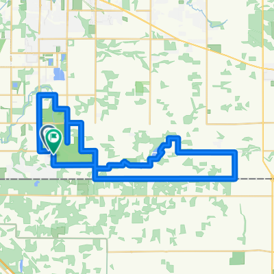
Other popular routes starting in Township of Langley
 Campbell Valley Park - Pacific Border Crossing
- Distance
- 8 km
- Ascent
- 114 m
- Descent
- 177 m
- Location
- Township of Langley, British Columbia, Canada
 New Abbey Route
- Distance
- 100.7 km
- Ascent
- 323 m
- Descent
- 323 m
- Location
- Township of Langley, British Columbia, Canada
 24245 61st Ave, Langley to 24245 61st Ave, Langley
- Distance
- 23.7 km
- Ascent
- 205 m
- Descent
- 202 m
- Location
- Township of Langley, British Columbia, Canada
 125 training ride
- Distance
- 124.7 km
- Ascent
- 329 m
- Descent
- 329 m
- Location
- Township of Langley, British Columbia, Canada
 rolling rural
- Distance
- 38.8 km
- Ascent
- 203 m
- Descent
- 203 m
- Location
- Township of Langley, British Columbia, Canada
 20/09/20
- Distance
- 64.9 km
- Ascent
- 101 m
- Descent
- 141 m
- Location
- Township of Langley, British Columbia, Canada
 Avenue to Avenue
- Distance
- 17.9 km
- Ascent
- 158 m
- Descent
- 135 m
- Location
- Township of Langley, British Columbia, Canada
 Route in Langley
- Distance
- 37.6 km
- Ascent
- 275 m
- Descent
- 274 m
- Location
- Township of Langley, British Columbia, Canada
Open it in the app