

Monster Tour 4.0
Monster Tour 4.0 Day 1
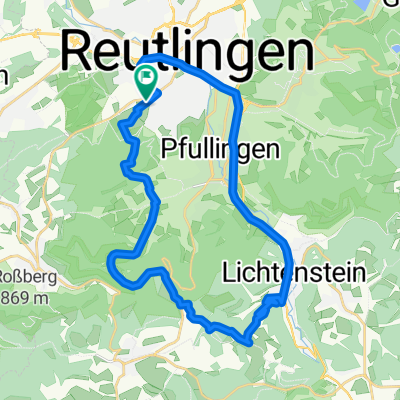
A cycling route starting in Reutlingen, Baden-Wurttemberg, Germany.
Overview
About this route
- 10 h 57 min
- Duration
- 158 km
- Distance
- 2,621 m
- Ascent
- 2,317 m
- Descent
- 14.4 km/h
- Avg. speed
- 810 m
- Max. altitude

Part of
Monster Tour 4.0
2 stages
Route quality
Waytypes & surfaces along the route
Waytypes
Track
59.8 km
(38 %)
Quiet road
36.2 km
(23 %)
Surfaces
Paved
125.2 km
(79 %)
Unpaved
17.5 km
(11 %)
Asphalt
111.9 km
(71 %)
Gravel
11.2 km
(7 %)
Route highlights
Points of interest along the route
Point of interest after 11.1 km
10% Steigung ... Akku fresser(!)
Point of interest after 24.8 km
Coffee break 30Km mark + Charge point
Point of interest after 62.6 km
Charger Cube
Point of interest after 118.6 km
E-Roller charging
Point of interest after 154.2 km
Donauursprung
Continue with Bikemap
Use, edit, or download this cycling route
You would like to ride Monster Tour 4.0 Day 1 or customize it for your own trip? Here is what you can do with this Bikemap route:
Free features
- Save this route as favorite or in collections
- Copy & plan your own version of this route
- Split it into stages to create a multi-day tour
- Sync your route with Garmin or Wahoo
Premium features
Free trial for 3 days, or one-time payment. More about Bikemap Premium.
- Navigate this route on iOS & Android
- Export a GPX / KML file of this route
- Create your custom printout (try it for free)
- Download this route for offline navigation
Discover more Premium features.
Get Bikemap PremiumFrom our community
Other popular routes starting in Reutlingen
 Reutlingen - Südrunde über Stuhlsteige
- Distance
- 63.5 km
- Ascent
- 578 m
- Descent
- 578 m
- Location
- Reutlingen, Baden-Wurttemberg, Germany
 Lautertal
- Distance
- 75.8 km
- Ascent
- 952 m
- Descent
- 945 m
- Location
- Reutlingen, Baden-Wurttemberg, Germany
 Rund um betzingenoerdelerstraße 53, Reutlingen nach Goerdelerstraße 53, Reutlingen
- Distance
- 41 km
- Ascent
- 573 m
- Descent
- 575 m
- Location
- Reutlingen, Baden-Wurttemberg, Germany
 Reutlingen - Lindenhof - Holzelfingen - Reutlingen
- Distance
- 32.2 km
- Ascent
- 408 m
- Descent
- 408 m
- Location
- Reutlingen, Baden-Wurttemberg, Germany
 Reutlingen - Pfullinger Berg - Genkingen
- Distance
- 16.5 km
- Ascent
- 541 m
- Descent
- 142 m
- Location
- Reutlingen, Baden-Wurttemberg, Germany
 Eninger Weide
- Distance
- 15.8 km
- Ascent
- 414 m
- Descent
- 26 m
- Location
- Reutlingen, Baden-Wurttemberg, Germany
 Reutlingen-Nebelhöhle
- Distance
- 29.1 km
- Ascent
- 534 m
- Descent
- 534 m
- Location
- Reutlingen, Baden-Wurttemberg, Germany
 Albtour
- Distance
- 107.2 km
- Ascent
- 947 m
- Descent
- 950 m
- Location
- Reutlingen, Baden-Wurttemberg, Germany
Open it in the app