

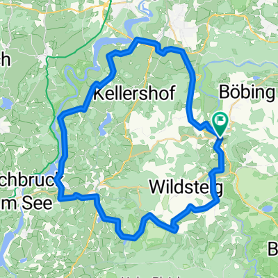
Rottenbuch-Murnau-Schwaiganger
A cycling route starting in Rottenbuch, Bavaria, Germany.
Overview
About this route
Connection of the cycling path Romantic Road with the Lake Constance-Königssee cycling path via Murnau
- -:--
- Duration
- 30.7 km
- Distance
- 304 m
- Ascent
- 411 m
- Descent
- ---
- Avg. speed
- ---
- Max. altitude
Route quality
Waytypes & surfaces along the route
Waytypes
Quiet road
7.1 km
(23 %)
Track
4 km
(13 %)
Surfaces
Paved
26.7 km
(87 %)
Unpaved
0.6 km
(2 %)
Asphalt
26.7 km
(87 %)
Gravel
0.3 km
(1 %)
Continue with Bikemap
Use, edit, or download this cycling route
You would like to ride Rottenbuch-Murnau-Schwaiganger or customize it for your own trip? Here is what you can do with this Bikemap route:
Free features
- Save this route as favorite or in collections
- Copy & plan your own version of this route
- Sync your route with Garmin or Wahoo
Premium features
Free trial for 3 days, or one-time payment. More about Bikemap Premium.
- Navigate this route on iOS & Android
- Export a GPX / KML file of this route
- Create your custom printout (try it for free)
- Download this route for offline navigation
Discover more Premium features.
Get Bikemap PremiumFrom our community
Other popular routes starting in Rottenbuch
 Rundfahrt Rottenbuch
- Distance
- 28.4 km
- Ascent
- 279 m
- Descent
- 256 m
- Location
- Rottenbuch, Bavaria, Germany
 Runde WiesUrspringKreutRB
- Distance
- 45.7 km
- Ascent
- 406 m
- Descent
- 406 m
- Location
- Rottenbuch, Bavaria, Germany
 Hohenpeißenberg Runde Süd
- Distance
- 41.6 km
- Ascent
- 632 m
- Descent
- 628 m
- Location
- Rottenbuch, Bavaria, Germany
 Rottenbuch Staffelsee Riegsee und zurück
- Distance
- 56.9 km
- Ascent
- 0 m
- Descent
- 0 m
- Location
- Rottenbuch, Bavaria, Germany
 Rottenbuch-Murnau-Schwaiganger
- Distance
- 30.7 km
- Ascent
- 304 m
- Descent
- 411 m
- Location
- Rottenbuch, Bavaria, Germany
 Faks 2017 Rundfahrt 1
- Distance
- 66.5 km
- Ascent
- 327 m
- Descent
- 322 m
- Location
- Rottenbuch, Bavaria, Germany
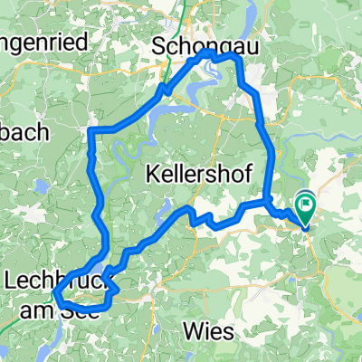 Rottenbuch-Lechbruck-Schongau-Peiting
- Distance
- 54.1 km
- Ascent
- 365 m
- Descent
- 368 m
- Location
- Rottenbuch, Bavaria, Germany
 Sonnenbichl-Weg Nr.93, Schönberg
- Distance
- 12 km
- Ascent
- 322 m
- Descent
- 322 m
- Location
- Rottenbuch, Bavaria, Germany
Open it in the app