
Vozokany-Jelka mlyn-Vozokany
- 54.7 km
- 58 m
- 102 m
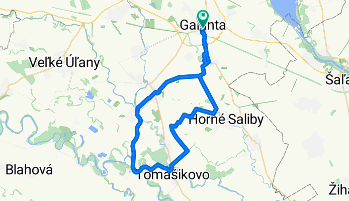
- Galanta, Trnava Region, Slovakia
A cycling route starting in Galanta, Trnava Region, Slovakia.
Overview
created this 1 year ago
Route quality
Track
17.7 km
48 %
Quiet road
9.6 km
26 %
Paved
8.1 km
(22 %)
Unpaved
7.4 km
(20 %)
Ground
6.3 km
17 %
Concrete
4.4 km
12 %
Continue with Bikemap
You would like to ride galanta - tomasikovo or customize it for your own trip? Here is what you can do with this Bikemap route:
Free trial for 3 days, or one-time payment. More about Bikemap Premium.
Discover more Premium features.
Get Bikemap PremiumFrom our community
Open it in the app