

Drauradweg
A cycling route starting in Natz-Schabs, Trentino-Alto Adige, Italy.
Overview
About this route
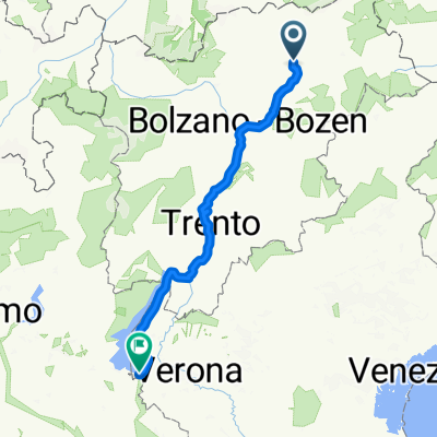
From Franzensfeste to Klagenfurt. A very nice bike path, especially in South Tyrol, almost entirely paved, even partly suitable for road bikes.
- -:--
- Duration
- 261.9 km
- Distance
- 877 m
- Ascent
- 1,157 m
- Descent
- ---
- Avg. speed
- ---
- Max. altitude
Continue with Bikemap
Use, edit, or download this cycling route
You would like to ride Drauradweg or customize it for your own trip? Here is what you can do with this Bikemap route:
Free features
- Save this route as favorite or in collections
- Copy & plan your own version of this route
- Split it into stages to create a multi-day tour
- Sync your route with Garmin or Wahoo
Premium features
Free trial for 3 days, or one-time payment. More about Bikemap Premium.
- Navigate this route on iOS & Android
- Export a GPX / KML file of this route
- Create your custom printout (try it for free)
- Download this route for offline navigation
Discover more Premium features.
Get Bikemap PremiumFrom our community
Other popular routes starting in Natz-Schabs
 Aicha - Ronerhütte
- Distance
- 19.4 km
- Ascent
- 1,282 m
- Descent
- 172 m
- Location
- Natz-Schabs, Trentino-Alto Adige, Italy
 Brenner-Franzenfeste
- Distance
- 60.8 km
- Ascent
- 1,274 m
- Descent
- 817 m
- Location
- Natz-Schabs, Trentino-Alto Adige, Italy
 Tag 1 (Schabs-Prissian) 4:47
- Distance
- 68 km
- Ascent
- 505 m
- Descent
- 667 m
- Location
- Natz-Schabs, Trentino-Alto Adige, Italy
 Teil 6: Pustertalradweg: Varna - Toblach
- Distance
- 60.7 km
- Ascent
- 718 m
- Descent
- 198 m
- Location
- Natz-Schabs, Trentino-Alto Adige, Italy
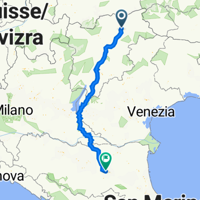
 Ciclovia del Sole - Brennero-Lago di Garda (26/06-29-06/25)
- Distance
- 220.5 km
- Ascent
- 2,102 m
- Descent
- 2,735 m
- Location
- Natz-Schabs, Trentino-Alto Adige, Italy
 Pustertaler Straße 5A, Natz-Schabs to Via Emilia Ponente 76c, Bologna
- Distance
- 370.1 km
- Ascent
- 1,783 m
- Descent
- 2,508 m
- Location
- Natz-Schabs, Trentino-Alto Adige, Italy
 von Brixen durch die Dolomiten nach Cres
- Distance
- 424.7 km
- Ascent
- 1,947 m
- Descent
- 2,651 m
- Location
- Natz-Schabs, Trentino-Alto Adige, Italy
 KESCHTNWEG - SÜDTIROL
- Distance
- 121.2 km
- Ascent
- 3,039 m
- Descent
- 2,827 m
- Location
- Natz-Schabs, Trentino-Alto Adige, Italy
Open it in the app