

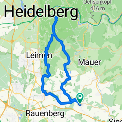
Dielheim-kraichgau
A cycling route starting in Horrenberg, Baden-Wurttemberg, Germany.
Overview
About this route
The more you write here, the more helpful it is for other users.* Route course.* Why do you like this route?* Why do you recommend it?* What are the highlights?* etc.
- -:--
- Duration
- 97.7 km
- Distance
- 969 m
- Ascent
- 877 m
- Descent
- ---
- Avg. speed
- ---
- Max. altitude
Route quality
Waytypes & surfaces along the route
Waytypes
Road
26.4 km
(27 %)
Quiet road
4.9 km
(5 %)
Surfaces
Paved
80.1 km
(82 %)
Unpaved
2.9 km
(3 %)
Asphalt
79.2 km
(81 %)
Gravel
2.9 km
(3 %)
Continue with Bikemap
Use, edit, or download this cycling route
You would like to ride Dielheim-kraichgau or customize it for your own trip? Here is what you can do with this Bikemap route:
Free features
- Save this route as favorite or in collections
- Copy & plan your own version of this route
- Split it into stages to create a multi-day tour
- Sync your route with Garmin or Wahoo
Premium features
Free trial for 3 days, or one-time payment. More about Bikemap Premium.
- Navigate this route on iOS & Android
- Export a GPX / KML file of this route
- Create your custom printout (try it for free)
- Download this route for offline navigation
Discover more Premium features.
Get Bikemap PremiumFrom our community
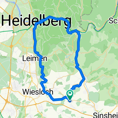
Other popular routes starting in Horrenberg
 Trailrunde am Königstuhl
- Distance
- 38.6 km
- Ascent
- 741 m
- Descent
- 714 m
- Location
- Horrenberg, Baden-Wurttemberg, Germany
 Horrenberg_HD_NG_Gaiberg_Nussloch_Loop
- Distance
- 53.3 km
- Ascent
- 316 m
- Descent
- 367 m
- Location
- Horrenberg, Baden-Wurttemberg, Germany
 Dielheim-kraichgau
- Distance
- 97.7 km
- Ascent
- 969 m
- Descent
- 877 m
- Location
- Horrenberg, Baden-Wurttemberg, Germany
 HBG-Königstuhl-HBG
- Distance
- 42.2 km
- Ascent
- 836 m
- Descent
- 836 m
- Location
- Horrenberg, Baden-Wurttemberg, Germany
 Kolpingstraße nach Kolpingstraße
- Distance
- 59.3 km
- Ascent
- 564 m
- Descent
- 612 m
- Location
- Horrenberg, Baden-Wurttemberg, Germany
 Dammbach Hinweg
- Distance
- 114.3 km
- Ascent
- 1,970 m
- Descent
- 1,877 m
- Location
- Horrenberg, Baden-Wurttemberg, Germany
 Horrenberg - Nürnberg
- Distance
- 210.5 km
- Ascent
- 967 m
- Descent
- 824 m
- Location
- Horrenberg, Baden-Wurttemberg, Germany
 Königstuhl 4 auf bikemap
- Distance
- 18.1 km
- Ascent
- 475 m
- Descent
- 81 m
- Location
- Horrenberg, Baden-Wurttemberg, Germany
Open it in the app