

Uriage - Le Balcon de Belledonne
A cycling route starting in Saint-Ismier, Auvergne-Rhône-Alpes, France.
Overview
About this route
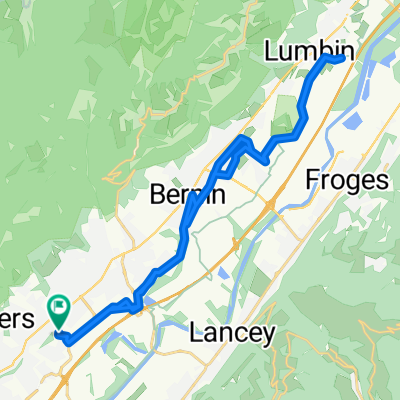
St Ismier - Lancey - Gières - Uriage - St Martin d'Uriage - Le Pinet d'Uriage - Le Mas Julien - St Mury Monteymond - Col des Mouilles - Col des Ayes - Theys - Col du Barioz - St Pierre d'Allevard - Goncelin - Lancey - St Ismier
- -:--
- Duration
- 114.9 km
- Distance
- 1,835 m
- Ascent
- 1,835 m
- Descent
- ---
- Avg. speed
- ---
- Max. altitude
Route quality
Waytypes & surfaces along the route
Waytypes
Road
21.8 km
(19 %)
Quiet road
13.8 km
(12 %)
Surfaces
Paved
66.6 km
(58 %)
Asphalt
65.5 km
(57 %)
Paved (undefined)
1.1 km
(1 %)
Undefined
48.3 km
(42 %)
Continue with Bikemap
Use, edit, or download this cycling route
You would like to ride Uriage - Le Balcon de Belledonne or customize it for your own trip? Here is what you can do with this Bikemap route:
Free features
- Save this route as favorite or in collections
- Copy & plan your own version of this route
- Split it into stages to create a multi-day tour
- Sync your route with Garmin or Wahoo
Premium features
Free trial for 3 days, or one-time payment. More about Bikemap Premium.
- Navigate this route on iOS & Android
- Export a GPX / KML file of this route
- Create your custom printout (try it for free)
- Download this route for offline navigation
Discover more Premium features.
Get Bikemap PremiumFrom our community
Other popular routes starting in Saint-Ismier
 Vallée d'Uriage - Brié - St Martin d'Uriage - Revel
- Distance
- 80.7 km
- Ascent
- 1,007 m
- Descent
- 1,011 m
- Location
- Saint-Ismier, Auvergne-Rhône-Alpes, France
 Montmélian - La Chapelle Blanche - St Maximin - Allevard
- Distance
- 101.1 km
- Ascent
- 979 m
- Descent
- 979 m
- Location
- Saint-Ismier, Auvergne-Rhône-Alpes, France
 Itinéraire Saint Ismier - Crolles
- Distance
- 12.1 km
- Ascent
- 161 m
- Descent
- 161 m
- Location
- Saint-Ismier, Auvergne-Rhône-Alpes, France
 Le Col de Marocaz
- Distance
- 112.8 km
- Ascent
- 1,086 m
- Descent
- 1,086 m
- Location
- Saint-Ismier, Auvergne-Rhône-Alpes, France
 Uriage - Le Balcon de Belledonne
- Distance
- 114.9 km
- Ascent
- 1,835 m
- Descent
- 1,835 m
- Location
- Saint-Ismier, Auvergne-Rhône-Alpes, France
 De Allée Fantin Latour 115, Montbonnot-Saint-Martin à Allée Fantin Latour 115, Montbonnot-Saint-Martin
- Distance
- 29.7 km
- Ascent
- 212 m
- Descent
- 230 m
- Location
- Saint-Ismier, Auvergne-Rhône-Alpes, France
 balcon de belledonne
- Distance
- 108.3 km
- Ascent
- 1,637 m
- Descent
- 1,636 m
- Location
- Saint-Ismier, Auvergne-Rhône-Alpes, France
 Chapareillan - Le Balcon de la Chartreuse
- Distance
- 75.3 km
- Ascent
- 1,312 m
- Descent
- 1,308 m
- Location
- Saint-Ismier, Auvergne-Rhône-Alpes, France
Open it in the app