

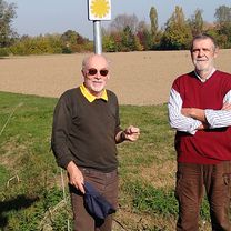
Jens Erik trip 2024
2 Oct Route Reggio Emilia to river Po
A cycling route starting in Reggio Emilia, Emilia-Romagna, Italy.
Overview
About this route
A route that stitches together stretches of cycle paths with stretches of minor roads crossing the plain from south to north in the "small capitals" of the history of the possessions of the Bentivoglio and Gonzaga families in the province of Reggio Emilia until reaching the Po river. We cross Bagnolo in Piano, Novellara and the suggestive territory of the Valleys, Guastalla with its Romanesque parish churches, the Palazzo Ducale up to the Lido Po at the old mooring of the pontoon bridge. From the Lido a floating bridge allows us to cross the Crostolo stream at the mouth of the Po and continue towards Gualtieri along the towpath which is now a cycle path. After a stop in the beautiful Piazza Bentivoglio (a square of 100 meters on each side) we return to Reggio Emilia, the embankment of the Crostolo stream, then the minor roads up to the town of Sesso and then the urban cycle paths to enter the city Percorso che ricuce tratti di piste ciclabili con tratti su viabilità minore attraversando la pianura da sud a nord nelle “piccole capitali” della storia dei possedimenti dei Bentivoglio e dei Gonzaga della provincia di Reggio Emilia fino da arrivare al fiume Po. Attraversiamo Bagnolo in Piano, Novellara e il territorio suggestivo delle Valli, Guastalla con le sue pievi romaniche il Palazzo Ducale fino al Lido Po in corrispondenza del vecchio attracco del ponte di barche. Dal Lido un ponte flottante ci consente di passare il torrente Crostolo alla foce del Po e di proseguire per Gualtieri lungo la strada alzaia oggi pista ciclabile. Dopo una sosta nella bella Piazza Bentivoglio (un quadrato di 100 metri di lato) ritorniamo a Reggio Emilia l’argine del torrente Crostolo quindi la viabilità minore fino all’abitato di Sesso e quindi le ciclabili urbane per entrare in città
- 4 h 18 min
- Duration
- 71.4 km
- Distance
- 82 m
- Ascent
- 79 m
- Descent
- 16.6 km/h
- Avg. speed
- 50 m
- Max. altitude

Part of
8 stages
Route quality
Waytypes & surfaces along the route
Waytypes
Quiet road
33.6 km
(47 %)
Cycleway
17.1 km
(24 %)
Surfaces
Paved
40.7 km
(57 %)
Unpaved
3.6 km
(5 %)
Asphalt
35 km
(49 %)
Paved (undefined)
3.6 km
(5 %)
Route highlights
Points of interest along the route

Point of interest after 11.2 km
Pieve Rossa romanesque church

Point of interest after 20.3 km
Main church

Point of interest after 29.7 km
Strada bianca
Point of interest after 32 km
Attention dangerous crossing

Point of interest after 34.8 km
Pieve di Guastalla church

Point of interest after 39 km
Lido Po lunch time

Point of interest after 39.2 km
Floating bridge

Point of interest after 39.4 km
Towpath cycling route

Point of interest after 42.4 km
Bentivoglio square

Point of interest after 44.4 km
White road to the bank of Crostolo stream

Point of interest after 45.9 km
Cycle-foot bridge on Crostolo Stream

Point of interest after 53.3 km
Argine Francone road
Continue with Bikemap
Use, edit, or download this cycling route
You would like to ride 2 Oct Route Reggio Emilia to river Po or customize it for your own trip? Here is what you can do with this Bikemap route:
Free features
- Save this route as favorite or in collections
- Copy & plan your own version of this route
- Sync your route with Garmin or Wahoo
Premium features
Free trial for 3 days, or one-time payment. More about Bikemap Premium.
- Navigate this route on iOS & Android
- Export a GPX / KML file of this route
- Create your custom printout (try it for free)
- Download this route for offline navigation
Discover more Premium features.
Get Bikemap PremiumFrom our community
Other popular routes starting in Reggio Emilia
 Reggio Emilia to Mamiano (Pr) Fondazione M.R.
- Distance
- 31.2 km
- Ascent
- 172 m
- Descent
- 68 m
- Location
- Reggio Emilia, Emilia-Romagna, Italy
 Reggio Emilia-ciclabile Crostolo-Quattro Castella
- Distance
- 20.3 km
- Ascent
- 132 m
- Descent
- 21 m
- Location
- Reggio Emilia, Emilia-Romagna, Italy
 Canossa da Reggio Canalina, via Montecavolo
- Distance
- 64.9 km
- Ascent
- 720 m
- Descent
- 720 m
- Location
- Reggio Emilia, Emilia-Romagna, Italy
 c) Percorso Gonzaghesco: Reggio Emilia - Novellara - Guastalla
- Distance
- 36 km
- Ascent
- 34 m
- Descent
- 63 m
- Location
- Reggio Emilia, Emilia-Romagna, Italy
 Giri in bici per famiglie Reggio-Bagnolo-Correggio A-R
- Distance
- 39.9 km
- Ascent
- 56 m
- Descent
- 54 m
- Location
- Reggio Emilia, Emilia-Romagna, Italy
 Cammino San Pellegrino
- Distance
- 95.7 km
- Ascent
- 2,895 m
- Descent
- 1,442 m
- Location
- Reggio Emilia, Emilia-Romagna, Italy
 Reggio Emilia_Quattro Castella Atualizado_28/05/2014
- Distance
- 16.2 km
- Ascent
- 117 m
- Descent
- 10 m
- Location
- Reggio Emilia, Emilia-Romagna, Italy
 reggio emilia - mauriziano
- Distance
- 29.2 km
- Ascent
- 36 m
- Descent
- 98 m
- Location
- Reggio Emilia, Emilia-Romagna, Italy
Open it in the app