

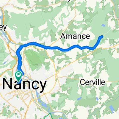
FR1-06_Nancy - Thaon-les-Vosges_72,2km 230hm
A cycling route starting in Maxéville, Grand Est, France.
Overview
About this route
- 4 h 28 min
- Duration
- 71.8 km
- Distance
- 273 m
- Ascent
- 163 m
- Descent
- 16.1 km/h
- Avg. speed
- 317 m
- Max. altitude

Route quality
Waytypes & surfaces along the route
Waytypes
Path
42.4 km
(59 %)
Access road
19.4 km
(27 %)
Surfaces
Paved
68.2 km
(95 %)
Asphalt
68.2 km
(95 %)
Undefined
3.6 km
(5 %)
Route highlights
Points of interest along the route
Point of interest after 0.4 km
Porte Désilles Die Porte Désilles (oder Mémorial Désilles ) ist ein Gedenktor in der französischen Stadt Nancy . Es befindet sich am Place du Luxembourg, an der nördlichen Verlängerung des Cours Léopold und der Esplanade du Souvenir-Français, an der Kreuzung der Rue Désilles, der Rue de Metz und der Rue de la Craffe. Es wurde zwischen 1782 und 1784 nach Plänen des Architekten Didier-Joseph-François Mélin auf Initiative des Comte de Stainville , Oberbefehlshaber von Lothringen, erbaut. Es sollte die Aussicht am Ende des Cours Léopold abschließen und den Blick auf die Route de Metz freigeben sowie den im amerikanischen Unabhängigkeitskrieg gefallenen Bürgern von Nancy ein Denkmal setzen. Sein Name war zunächst Porte Saint-Louis, dann Porte Stainville und nahm schließlich seinen heutigen Namen in Erinnerung an André Désilles und seinen Tod in der Nancy-Affäre an. Es wurde am 15. Januar 1925 unter Denkmalschutz gestellt.
Point of interest after 0.5 km
WC
Point of interest after 1 km
Little Niam Sandwich 17 Rue de Serre, 54000 Nancy
Point of interest after 1.1 km
Pomme de Pain - La maison du sandwich 57 Rue Saint-Jean, 54000 Nancy
Bike service after 1.1 km
Point of interest after 1.1 km
Green Bagel Café Nancy 11 Rue de la Visitation, 54000 Nancy
Point of interest after 1.3 km
Place Carnot mit dem Obelisk
Point of interest after 1.7 km
Basilique Saint-Epvre - Basilique du Sacré-Cœur de Nancy Die Basilika Saint-Epvre (Aussprache [sɛ̃.t‿ɛvʁ]) ist eine römisch-katholische Kirche in Nancy in Frankreich. Die Kirche im Bistum Nancy-Toul ist dem heiligen Aper, Bischof von Toul, gewidmet, dessen Reliquien in einem Schrein auf dem Hochaltar aufbewahrt werden, und trägt den Titel einer Basilica minor und eines Monument historique.
Point of interest after 1.8 km
Torhaus des Herzogenpalastes
Point of interest after 1.8 km
Schöner Brunnen
Bike service after 1.8 km
Point of interest after 2 km
Parc de la Pépinière Ein toller Park mit vielen historischen Gebäuden, und sehr schönen Bäumen und großen Wiesen sehr schön angelegt.
Point of interest after 2 km
Mozart Kiosk
Bike service after 2.1 km
Point of interest after 2.1 km
Rosarium
Point of interest after 2.1 km
WC
Bike service after 2.1 km
Point of interest after 2.2 km
WC
Point of interest after 3 km
WC
Point of interest after 3 km
Porte Sainte-Catherine 15 m hoch und 60 m breit. Teil der alten Stadtmauer.
Point of interest after 3 km
WC
Point of interest after 3 km
WC
Bike service after 3 km
Point of interest after 3.5 km
Food'Lab Nancy u.a. Sandwiches 61 Av. du XX Corps, 54000 Nancy
Point of interest after 3.5 km
WC
Point of interest after 3.6 km
WC
Point of interest after 4 km
WC
Point of interest after 4.7 km
WC
Bike service after 5.5 km
Point of interest after 5.7 km
La Tomblainoise
Bike service after 7 km
Point of interest after 10.3 km
EZEL KEBAB TACOS BURGER 13 Rue du Général Patton, 54410 Laneuveville-devant-Nancy
Point of interest after 16.5 km
Bistro La Parenthèse u.a. Sandwich 30 Rue du Ruisseau d'Urpont, 54710 Fléville-devant-Nancy
Point of interest after 21 km
Elektrizitätswerk "Turbinen" des Verbindungskanals Elektrizitätswerk "Turbinen" des Verbindungskanals
Point of interest after 26.4 km
Vielleicht Badestelle
Point of interest after 29.7 km
Le Menils St. Michel Charakteristisches Landhaus am Kanal.
Point of interest after 34.5 km
Notre-Dame-en-son-Assomption
Point of interest after 39.9 km
Chez Pascalou et Valoule kiosque à burgers - Wirtsgarten Rue de la Moselle, 54290 Bayon
Point of interest after 43.9 km
Plage de Bainville-Aux-Miroirs
Point of interest after 53.2 km
Port de Charmes
Point of interest after 53.2 km
Charmes Pizza 5 Rue Marcel Goulette, 88130 Charmes
Point of interest after 53.2 km
Boulangerie Bécherand 9 Rue Marcel Goulette, 88130 Charmes
Point of interest after 53.3 km
WC
Drinking water after 53.6 km
Point of interest after 58.1 km
Boulangerie pâtisserie chocolaterie Bécherand 4 Rue d'Alsace, 88450 Vincey
Point of interest after 63.9 km
Borne du Serment de Koufra The Capture of Kufra (French: Prise de Koufra, Italian: Cufra) was part of the Allied Western Desert Campaign during the Second World War. Kufra is a group of oases in the Kufra District of south-eastern Cyrenaica in the Libyan Desert. In 1940, it was part of the colony of Italian Libya Libia Italiana, which was part of Africa Settentrionale Italiana (ASI), which had been established in 1934. With some early assistance from the British Long Range Desert Group, Kufra was besieged from 31 January to 1 March 1941 by Free French forces which forced the surrender of the Italian and Libyan garrison.
Point of interest after 64.4 km
Alte Fabrik am Kanal Die Gebäude aus Backstein wirken wie ein Lost Place, in jedem Fall aber ein geschlossenes Ensemble direkt am Canal: beeindruckend!
Point of interest after 69.5 km
Badestrand?
Point of interest after 70.9 km
Franky Pizza 35 Rue de Lorraine, 88150 Thaon-les-Vosges
Point of interest after 71.4 km
ZONE KEBAB 15 Av. des Fusillés, 88150 Thaon-les-Vosges
Accommodation after 71.8 km
Hôtel Bar Restaurant de la Gare
Point of interest after 71.8 km
A LA BIEN' - Pizza, Billard 115 Av. des Fusillés, 88150 Thaon-les-Vosges
Accommodation after 71.8 km
La Maison Bleue "La Charade" 88150 Thaon-les-Vosges 1 Rue Bel-air
Continue with Bikemap
Use, edit, or download this cycling route
You would like to ride FR1-06_Nancy - Thaon-les-Vosges_72,2km 230hm or customize it for your own trip? Here is what you can do with this Bikemap route:
Free features
- Save this route as favorite or in collections
- Copy & plan your own version of this route
- Sync your route with Garmin or Wahoo
Premium features
Free trial for 3 days, or one-time payment. More about Bikemap Premium.
- Navigate this route on iOS & Android
- Export a GPX / KML file of this route
- Create your custom printout (try it for free)
- Download this route for offline navigation
Discover more Premium features.
Get Bikemap PremiumFrom our community
Other popular routes starting in Maxéville
 Nancy to Épinal
- Distance
- 78.6 km
- Ascent
- 329 m
- Descent
- 209 m
- Location
- Maxéville, Grand Est, France
 FR1-06_Nancy - Thaon-les-Vosges_72,2km 230hm
- Distance
- 71.8 km
- Ascent
- 273 m
- Descent
- 163 m
- Location
- Maxéville, Grand Est, France
 Lengthy ride through Nancy
- Distance
- 46.1 km
- Ascent
- 190 m
- Descent
- 190 m
- Location
- Maxéville, Grand Est, France
 Long bike tour through Nancy
- Distance
- 39.2 km
- Ascent
- 92 m
- Descent
- 92 m
- Location
- Maxéville, Grand Est, France
 nancy- verdun
- Distance
- 137.3 km
- Ascent
- 326 m
- Descent
- 338 m
- Location
- Maxéville, Grand Est, France
 entraînement retour
- Distance
- 17.6 km
- Ascent
- 58 m
- Descent
- 74 m
- Location
- Maxéville, Grand Est, France
 Long bike tour through Nancy
- Distance
- 47.2 km
- Ascent
- 200 m
- Descent
- 200 m
- Location
- Maxéville, Grand Est, France
 Nancy Chaligny Champigneules Nancy
- Distance
- 49.3 km
- Ascent
- 286 m
- Descent
- 287 m
- Location
- Maxéville, Grand Est, France
Open it in the app