

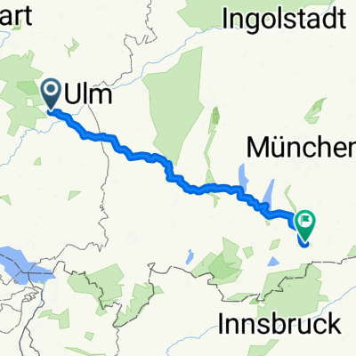
MTB - Sotzenhausen
A cycling route starting in Allmendingen, Baden-Wurttemberg, Germany.
Overview
About this route
Nice loop on mostly paved roads and a bit of gravel.
The climb in Sotzenhausen is no walk in the park, but otherwise very nice to ride.
Duration about 2.5 hours.
- -:--
- Duration
- 26.9 km
- Distance
- 335 m
- Ascent
- 337 m
- Descent
- ---
- Avg. speed
- ---
- Max. altitude
Route quality
Waytypes & surfaces along the route
Waytypes
Track
14.8 km
(55 %)
Quiet road
9.2 km
(34 %)
Surfaces
Paved
17 km
(63 %)
Unpaved
7 km
(26 %)
Asphalt
14 km
(52 %)
Gravel
5.4 km
(20 %)
Continue with Bikemap
Use, edit, or download this cycling route
You would like to ride MTB - Sotzenhausen or customize it for your own trip? Here is what you can do with this Bikemap route:
Free features
- Save this route as favorite or in collections
- Copy & plan your own version of this route
- Sync your route with Garmin or Wahoo
Premium features
Free trial for 3 days, or one-time payment. More about Bikemap Premium.
- Navigate this route on iOS & Android
- Export a GPX / KML file of this route
- Create your custom printout (try it for free)
- Download this route for offline navigation
Discover more Premium features.
Get Bikemap PremiumFrom our community
Other popular routes starting in Allmendingen
 WETour Dächingen
- Distance
- 38.9 km
- Ascent
- 542 m
- Descent
- 544 m
- Location
- Allmendingen, Baden-Wurttemberg, Germany
 Haselweg 6, Allmendingen nach Haselweg 1, Allmendingen
- Distance
- 17 km
- Ascent
- 209 m
- Descent
- 209 m
- Location
- Allmendingen, Baden-Wurttemberg, Germany
 Riedäckerstraße, Allmendingen do Hubertus-Liebrecht-Straße 35, Biberach an der Riß
- Distance
- 30.5 km
- Ascent
- 222 m
- Descent
- 220 m
- Location
- Allmendingen, Baden-Wurttemberg, Germany
 Bergtrainingsstrecke (Schmiechtal)
- Distance
- 56.9 km
- Ascent
- 1,195 m
- Descent
- 1,266 m
- Location
- Allmendingen, Baden-Wurttemberg, Germany
 MTB - Sotzenhausen
- Distance
- 26.9 km
- Ascent
- 335 m
- Descent
- 337 m
- Location
- Allmendingen, Baden-Wurttemberg, Germany
 Trailrunde Gelobtes Land
- Distance
- 27.7 km
- Ascent
- 541 m
- Descent
- 541 m
- Location
- Allmendingen, Baden-Wurttemberg, Germany
 Grosse Lautertal MTB Tour
- Distance
- 59.6 km
- Ascent
- 591 m
- Descent
- 591 m
- Location
- Allmendingen, Baden-Wurttemberg, Germany
 Alpen2012_Aug_Et-1_Allmendingen_Lenggries
- Distance
- 211.3 km
- Ascent
- 895 m
- Descent
- 712 m
- Location
- Allmendingen, Baden-Wurttemberg, Germany
Open it in the app