

Motorrad
2024-07-19 Motorrad (Hemberg, Appenzell, Lechtal, Allgäuer Alpen, Klausenpass)
A cycling route starting in Obfelden / Oberlunnern, Canton of Zurich, Switzerland.
Overview
About this route
- -:--
- Duration
- 691.2 km
- Distance
- 9,756 m
- Ascent
- 9,743 m
- Descent
- ---
- Avg. speed
- 2,002 m
- Max. altitude

Part of
Motorrad
7 stages
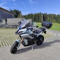
Route photos
\"")
\"")
\"")
\"")
\"")
\"")
Continue with Bikemap
Use, edit, or download this cycling route
You would like to ride 2024-07-19 Motorrad (Hemberg, Appenzell, Lechtal, Allgäuer Alpen, Klausenpass) or customize it for your own trip? Here is what you can do with this Bikemap route:
Free features
- Save this route as favorite or in collections
- Copy & plan your own version of this route
- Split it into stages to create a multi-day tour
- Sync your route with Garmin or Wahoo
Premium features
Free trial for 3 days, or one-time payment. More about Bikemap Premium.
- Navigate this route on iOS & Android
- Export a GPX / KML file of this route
- Create your custom printout (try it for free)
- Download this route for offline navigation
Discover more Premium features.
Get Bikemap PremiumFrom our community
Other popular routes starting in Obfelden / Oberlunnern
 Einfache Fahrt in Obfelden
- Distance
- 42.3 km
- Ascent
- 523 m
- Descent
- 522 m
- Location
- Obfelden / Oberlunnern, Canton of Zurich, Switzerland
 Obfelden Stetten 42km
- Distance
- 42.2 km
- Ascent
- 241 m
- Descent
- 244 m
- Location
- Obfelden / Oberlunnern, Canton of Zurich, Switzerland
 Obfelden - Zürich Altstetten (easy)
- Distance
- 24.9 km
- Ascent
- 217 m
- Descent
- 223 m
- Location
- Obfelden / Oberlunnern, Canton of Zurich, Switzerland
 Obfelden - Zürich Altstetten Best
- Distance
- 25.2 km
- Ascent
- 223 m
- Descent
- 230 m
- Location
- Obfelden / Oberlunnern, Canton of Zurich, Switzerland
 Obfelden -Oerlikon
- Distance
- 33 km
- Ascent
- 367 m
- Descent
- 349 m
- Location
- Obfelden / Oberlunnern, Canton of Zurich, Switzerland
 2024-07-19 Motorrad (Hemberg, Appenzell, Lechtal)
- Distance
- 269.5 km
- Ascent
- 4,583 m
- Descent
- 3,738 m
- Location
- Obfelden / Oberlunnern, Canton of Zurich, Switzerland
 Reussrunde Bremgarten
- Distance
- 34.8 km
- Ascent
- 321 m
- Descent
- 318 m
- Location
- Obfelden / Oberlunnern, Canton of Zurich, Switzerland
 Sepp's Ämtlerweg
- Distance
- 42.3 km
- Ascent
- 781 m
- Descent
- 739 m
- Location
- Obfelden / Oberlunnern, Canton of Zurich, Switzerland
Open it in the app