

Balade en Bugey
A cycling route starting in Saint-Rambert-en-Bugey, Auvergne-Rhône-Alpes, France.
Overview
About this route
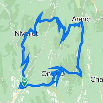
Balade dans le Bugey depuis Saint Rambert en Bugey et passant par 11 cols.
Tous routiers sauf le golet de Petrement a coté de saint rambert en Bugey
- -:--
- Duration
- 53.4 km
- Distance
- 1,110 m
- Ascent
- 1,113 m
- Descent
- ---
- Avg. speed
- ---
- Max. altitude
Route quality
Waytypes & surfaces along the route
Waytypes
Road
34.1 km
(64 %)
Busy road
7.8 km
(15 %)
Surfaces
Paved
3.9 km
(7 %)
Unpaved
1.8 km
(3 %)
Asphalt
3.9 km
(7 %)
Gravel
1.8 km
(3 %)
Undefined
47.8 km
(89 %)
Route highlights
Points of interest along the route
Point of interest after 14.3 km
Golet du Sapey 940m
Point of interest after 19.2 km
Col d'Evosges
Point of interest after 24.7 km
Col des Pezieres
Point of interest after 30.8 km
Col de la Berche
Point of interest after 32.7 km
Col du Cruchon
Point of interest after 32.7 km
Col de Pisseloup
Point of interest after 36.9 km
Golet du Geai
Point of interest after 36.9 km
Col de Ceignes 646m
Point of interest after 39 km
Col du Cendrier
Point of interest after 47.3 km
Col de Nivollet
Continue with Bikemap
Use, edit, or download this cycling route
You would like to ride Balade en Bugey or customize it for your own trip? Here is what you can do with this Bikemap route:
Free features
- Save this route as favorite or in collections
- Copy & plan your own version of this route
- Sync your route with Garmin or Wahoo
Premium features
Free trial for 3 days, or one-time payment. More about Bikemap Premium.
- Navigate this route on iOS & Android
- Export a GPX / KML file of this route
- Create your custom printout (try it for free)
- Download this route for offline navigation
Discover more Premium features.
Get Bikemap PremiumFrom our community
Other popular routes starting in Saint-Rambert-en-Bugey
 Col de la berche
- Distance
- 51.4 km
- Ascent
- 760 m
- Descent
- 760 m
- Location
- Saint-Rambert-en-Bugey, Auvergne-Rhône-Alpes, France
 Bugey
Bugey- Distance
- 58.3 km
- Ascent
- 1,313 m
- Descent
- 1,313 m
- Location
- Saint-Rambert-en-Bugey, Auvergne-Rhône-Alpes, France
 Tour Ain 40 km
- Distance
- 42 km
- Ascent
- 204 m
- Descent
- 206 m
- Location
- Saint-Rambert-en-Bugey, Auvergne-Rhône-Alpes, France
 tour bugey
- Distance
- 35.9 km
- Ascent
- 813 m
- Descent
- 813 m
- Location
- Saint-Rambert-en-Bugey, Auvergne-Rhône-Alpes, France
 route de campagne
- Distance
- 35.6 km
- Ascent
- 746 m
- Descent
- 738 m
- Location
- Saint-Rambert-en-Bugey, Auvergne-Rhône-Alpes, France
 Saint-Rambert - Indrieux - Plomb - Tenay
- Distance
- 20.6 km
- Ascent
- 742 m
- Descent
- 685 m
- Location
- Saint-Rambert-en-Bugey, Auvergne-Rhône-Alpes, France
 Balade en Bugey
- Distance
- 53.4 km
- Ascent
- 1,110 m
- Descent
- 1,113 m
- Location
- Saint-Rambert-en-Bugey, Auvergne-Rhône-Alpes, France
 Col de Portes depuis St Rambert en Bugey
- Distance
- 37.1 km
- Ascent
- 782 m
- Descent
- 783 m
- Location
- Saint-Rambert-en-Bugey, Auvergne-Rhône-Alpes, France
Open it in the app