VITORIA GASTEIZ GREEN BELT
A cycling route starting in Vitoria-Gasteiz, Basque Country, Spain.
Overview
About this route
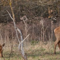
Easy route, with hardly any unevenness, with a total of 33 kilometers. It can be done at any time of the year and is ideal for enjoying the Salburua wetlands with its Ataria Interpretation Center with the family and without rushing; the Zadorra Linear Park; the Zabalgana Forest; Armentia; and Olarizu, in addition to many other natural spaces... And very importantly, without leaving the city of Vitoria-Gasteiz
- -:--
- Duration
- 33 km
- Distance
- 234 m
- Ascent
- 236 m
- Descent
- ---
- Avg. speed
- 601 m
- Max. altitude
Route photos
Continue with Bikemap
Use, edit, or download this cycling route
You would like to ride VITORIA GASTEIZ GREEN BELT or customize it for your own trip? Here is what you can do with this Bikemap route:
Free features
- Save this route as favorite or in collections
- Copy & plan your own version of this route
- Sync your route with Garmin or Wahoo
Premium features
Free trial for 3 days, or one-time payment. More about Bikemap Premium.
- Navigate this route on iOS & Android
- Export a GPX / KML file of this route
- Create your custom printout (try it for free)
- Download this route for offline navigation
Discover more Premium features.
Get Bikemap PremiumFrom our community
Other popular routes starting in Vitoria-Gasteiz
 GREAT CYCLE TOURIST ROUTE OF THE LLANADA ALAVESA
- Distance
- 118.6 km
- Ascent
- 1,033 m
- Descent
- 1,034 m
- Location
- Vitoria-Gasteiz, Basque Country, Spain
 Deutschland - Portugal (Berlin - Faro) SP 04 Lermanda - (Gesaltza) - Pancorbo
- Distance
- 48.3 km
- Ascent
- 660 m
- Descent
- 617 m
- Location
- Vitoria-Gasteiz, Basque Country, Spain
 Gasteiz-Trespuentes-Ganalto-Apodaka-Gasteiz
- Distance
- 48.9 km
- Ascent
- 476 m
- Descent
- 475 m
- Location
- Vitoria-Gasteiz, Basque Country, Spain
 Vitoria - Okina
- Distance
- 13.7 km
- Ascent
- 371 m
- Descent
- 113 m
- Location
- Vitoria-Gasteiz, Basque Country, Spain
 en la ruta
- Distance
- 27 km
- Ascent
- 333 m
- Descent
- 336 m
- Location
- Vitoria-Gasteiz, Basque Country, Spain
 VITORIA GASTEIZ GREEN BELT
- Distance
- 33 km
- Ascent
- 234 m
- Descent
- 236 m
- Location
- Vitoria-Gasteiz, Basque Country, Spain
 VITORIA BADAIA_ GANALTO
- Distance
- 33.7 km
- Ascent
- 612 m
- Descent
- 612 m
- Location
- Vitoria-Gasteiz, Basque Country, Spain
 en la ruta
- Distance
- 41.8 km
- Ascent
- 408 m
- Descent
- 415 m
- Location
- Vitoria-Gasteiz, Basque Country, Spain
Open it in the app


