

De Ludo-Mayer-Straße 1, Offenbach am Main a Nordendstraße 67, Langen (Hessen)
A cycling route starting in Offenbach, Hesse, Germany.
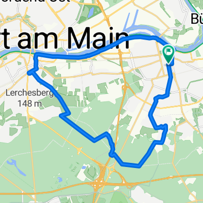
Overview
About this route
- 1 h 36 min
- Duration
- 19.5 km
- Distance
- 69 m
- Ascent
- 82 m
- Descent
- 12.1 km/h
- Avg. speed
- 146 m
- Max. altitude
Route quality
Waytypes & surfaces along the route
Waytypes
Quiet road
6.6 km
(34 %)
Path
3.7 km
(19 %)
Surfaces
Paved
16.7 km
(86 %)
Asphalt
16.5 km
(85 %)
Paved (undefined)
0.2 km
(1 %)
Undefined
2.7 km
(14 %)
Continue with Bikemap
Use, edit, or download this cycling route
You would like to ride De Ludo-Mayer-Straße 1, Offenbach am Main a Nordendstraße 67, Langen (Hessen) or customize it for your own trip? Here is what you can do with this Bikemap route:
Free features
- Save this route as favorite or in collections
- Copy & plan your own version of this route
- Sync your route with Garmin or Wahoo
Premium features
Free trial for 3 days, or one-time payment. More about Bikemap Premium.
- Navigate this route on iOS & Android
- Export a GPX / KML file of this route
- Create your custom printout (try it for free)
- Download this route for offline navigation
Discover more Premium features.
Get Bikemap PremiumFrom our community
Other popular routes starting in Offenbach
 Nidda Tour Stockhausen
- Distance
- 83.3 km
- Ascent
- 555 m
- Descent
- 379 m
- Location
- Offenbach, Hesse, Germany
 110 Eschbacher Klippen Taunus
- Distance
- 108.5 km
- Ascent
- 885 m
- Descent
- 884 m
- Location
- Offenbach, Hesse, Germany
 Einmal Stadtteil-Fechenheim nach Stadtteil-Höchst und zurück nach Fechenheim
- Distance
- 40.7 km
- Ascent
- 49 m
- Descent
- 49 m
- Location
- Offenbach, Hesse, Germany
 Einmal Airport und zurück
- Distance
- 62.1 km
- Ascent
- 104 m
- Descent
- 103 m
- Location
- Offenbach, Hesse, Germany
 Goetheturmfahrt
- Distance
- 18.5 km
- Ascent
- 85 m
- Descent
- 92 m
- Location
- Offenbach, Hesse, Germany
 Wetterau Rennrad
- Distance
- 48.3 km
- Ascent
- 175 m
- Descent
- 175 m
- Location
- Offenbach, Hesse, Germany
 Von Park zu Park in Offenbach
- Distance
- 17.6 km
- Ascent
- 108 m
- Descent
- 108 m
- Location
- Offenbach, Hesse, Germany
 OF-Götzemhain-Dietzenbach-Rodgau-OF
- Distance
- 37.4 km
- Ascent
- 123 m
- Descent
- 110 m
- Location
- Offenbach, Hesse, Germany
Open it in the app