

Les Corniches du Drac
A cycling route starting in Saint-Ismier, Auvergne-Rhône-Alpes, France.
Overview
About this route
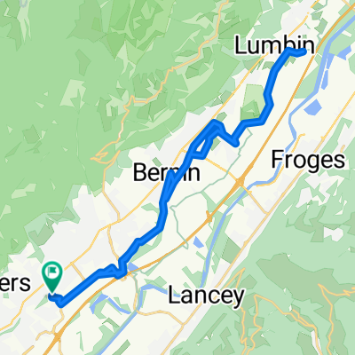
St Ismier - Lancey - Domène - Uriage - Brié Vizille - Jarrie - Monteynard - La Motte St Martin Mayres-Savel - La Mure - La Motte d'Aveillan Champ-sur-Drac - Vizille - Uriage - Domène Lancey - St Ismier
- -:--
- Duration
- 146.7 km
- Distance
- 1,494 m
- Ascent
- 1,494 m
- Descent
- ---
- Avg. speed
- ---
- Max. altitude
Route quality
Waytypes & surfaces along the route
Waytypes
Quiet road
20.5 km
(14 %)
Road
10.3 km
(7 %)
Surfaces
Paved
93.9 km
(64 %)
Asphalt
93.9 km
(64 %)
Undefined
52.8 km
(36 %)
Continue with Bikemap
Use, edit, or download this cycling route
You would like to ride Les Corniches du Drac or customize it for your own trip? Here is what you can do with this Bikemap route:
Free features
- Save this route as favorite or in collections
- Copy & plan your own version of this route
- Split it into stages to create a multi-day tour
- Sync your route with Garmin or Wahoo
Premium features
Free trial for 3 days, or one-time payment. More about Bikemap Premium.
- Navigate this route on iOS & Android
- Export a GPX / KML file of this route
- Create your custom printout (try it for free)
- Download this route for offline navigation
Discover more Premium features.
Get Bikemap PremiumFrom our community
Other popular routes starting in Saint-Ismier
 plaine
- Distance
- 32.6 km
- Ascent
- 217 m
- Descent
- 225 m
- Location
- Saint-Ismier, Auvergne-Rhône-Alpes, France
 Chapareillan - Le Balcon de la Chartreuse
- Distance
- 75.3 km
- Ascent
- 1,312 m
- Descent
- 1,308 m
- Location
- Saint-Ismier, Auvergne-Rhône-Alpes, France
 Montmélian - La Chapelle Blanche - St Maximin - Allevard
- Distance
- 101.1 km
- Ascent
- 979 m
- Descent
- 979 m
- Location
- Saint-Ismier, Auvergne-Rhône-Alpes, France
 De Allée Fantin Latour 115, Montbonnot-Saint-Martin à Allée Fantin Latour 115, Montbonnot-Saint-Martin
- Distance
- 29.7 km
- Ascent
- 212 m
- Descent
- 230 m
- Location
- Saint-Ismier, Auvergne-Rhône-Alpes, France
 col de la croix des Adrets
- Distance
- 50.6 km
- Ascent
- 858 m
- Descent
- 868 m
- Location
- Saint-Ismier, Auvergne-Rhône-Alpes, France
 Les Corniches du Drac
- Distance
- 146.7 km
- Ascent
- 1,494 m
- Descent
- 1,494 m
- Location
- Saint-Ismier, Auvergne-Rhône-Alpes, France
 Itinéraire Saint Ismier - Crolles
- Distance
- 12.1 km
- Ascent
- 161 m
- Descent
- 161 m
- Location
- Saint-Ismier, Auvergne-Rhône-Alpes, France
 Uriage - Le Balcon de Belledonne
- Distance
- 114.9 km
- Ascent
- 1,835 m
- Descent
- 1,835 m
- Location
- Saint-Ismier, Auvergne-Rhône-Alpes, France
Open it in the app