

Hohnsteiner Verdauerli
A cycling route starting in Hohnstein, Saxony, Germany.
Overview
About this route
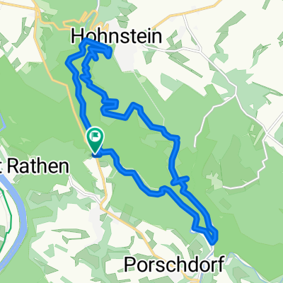
Small interval training on very nice side roads in the national park municipality of Hohnstein. A small highlight for the pulse is always and inevitably the Goßdorf ramp out of the idyllic Sebnitztal. That's where the afternoon nap always comes to an end...
- -:--
- Duration
- 41.4 km
- Distance
- 743 m
- Ascent
- 785 m
- Descent
- ---
- Avg. speed
- 380 m
- Max. altitude
Route quality
Waytypes & surfaces along the route
Waytypes
Road
14.1 km
(34 %)
Quiet road
9.9 km
(24 %)
Surfaces
Paved
32.3 km
(78 %)
Unpaved
3.3 km
(8 %)
Asphalt
31.1 km
(75 %)
Ground
3.3 km
(8 %)
Continue with Bikemap
Use, edit, or download this cycling route
You would like to ride Hohnsteiner Verdauerli or customize it for your own trip? Here is what you can do with this Bikemap route:
Free features
- Save this route as favorite or in collections
- Copy & plan your own version of this route
- Sync your route with Garmin or Wahoo
Premium features
Free trial for 3 days, or one-time payment. More about Bikemap Premium.
- Navigate this route on iOS & Android
- Export a GPX / KML file of this route
- Create your custom printout (try it for free)
- Download this route for offline navigation
Discover more Premium features.
Get Bikemap PremiumFrom our community
Other popular routes starting in Hohnstein
 MTB Wesenitz
- Distance
- 32.1 km
- Ascent
- 503 m
- Descent
- 513 m
- Location
- Hohnstein, Saxony, Germany
 Hohnsteiner Verdauerli
- Distance
- 41.4 km
- Ascent
- 743 m
- Descent
- 785 m
- Location
- Hohnstein, Saxony, Germany
 Bei Rathen
- Distance
- 4.6 km
- Ascent
- 264 m
- Descent
- 262 m
- Location
- Hohnstein, Saxony, Germany
 Rathen-Hinterhermsdorf-Rathen
- Distance
- 86.5 km
- Ascent
- 811 m
- Descent
- 813 m
- Location
- Hohnstein, Saxony, Germany
 Rundtour Felsschluchten Kurort Rathen
- Distance
- 12.5 km
- Ascent
- 402 m
- Descent
- 393 m
- Location
- Hohnstein, Saxony, Germany
 Elberadweg in CZ; then back through northern CZ
- Distance
- 589.5 km
- Ascent
- 1,136 m
- Descent
- 1,137 m
- Location
- Hohnstein, Saxony, Germany
 Polenztal zur Gautschgrotte
- Distance
- 14.5 km
- Ascent
- 362 m
- Descent
- 363 m
- Location
- Hohnstein, Saxony, Germany
 rathen hohenstein polenztal rathen
- Distance
- 14.3 km
- Ascent
- 449 m
- Descent
- 449 m
- Location
- Hohnstein, Saxony, Germany
Open it in the app