

Schotterunterwühler
A cycling route starting in Hollfeld, Bavaria, Germany.
Overview
About this route
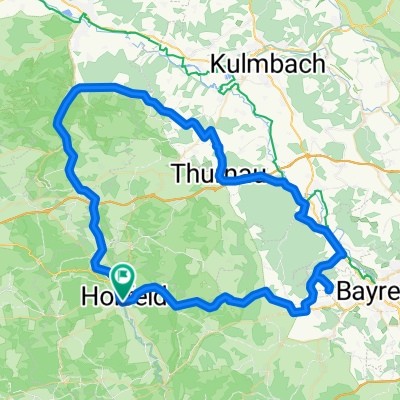
From Hollfeld to Königsfeld, a true mountain and valley track. Occasionally 15% incline.
- -:--
- Duration
- 21.2 km
- Distance
- 234 m
- Ascent
- 224 m
- Descent
- ---
- Avg. speed
- ---
- Max. altitude
Route quality
Waytypes & surfaces along the route
Waytypes
Road
9.1 km
(43 %)
Quiet road
0.4 km
(2 %)
Undefined
11.7 km
(55 %)
Surfaces
Paved
10.8 km
(51 %)
Asphalt
10.8 km
(51 %)
Undefined
10.4 km
(49 %)
Continue with Bikemap
Use, edit, or download this cycling route
You would like to ride Schotterunterwühler or customize it for your own trip? Here is what you can do with this Bikemap route:
Free features
- Save this route as favorite or in collections
- Copy & plan your own version of this route
- Sync your route with Garmin or Wahoo
Premium features
Free trial for 3 days, or one-time payment. More about Bikemap Premium.
- Navigate this route on iOS & Android
- Export a GPX / KML file of this route
- Create your custom printout (try it for free)
- Download this route for offline navigation
Discover more Premium features.
Get Bikemap PremiumFrom our community
Other popular routes starting in Hollfeld
 Hollfeld-Heiligenstadt
- Distance
- 62.5 km
- Ascent
- 535 m
- Descent
- 536 m
- Location
- Hollfeld, Bavaria, Germany
 Holl1
Holl1- Distance
- 41.9 km
- Ascent
- 395 m
- Descent
- 369 m
- Location
- Hollfeld, Bavaria, Germany
 Fränkische um Hollfeld
- Distance
- 78.3 km
- Ascent
- 625 m
- Descent
- 625 m
- Location
- Hollfeld, Bavaria, Germany
 Schotterunterwühler
- Distance
- 21.2 km
- Ascent
- 234 m
- Descent
- 224 m
- Location
- Hollfeld, Bavaria, Germany
 Hollfeld - Marktleugast
- Distance
- 117.2 km
- Ascent
- 1,243 m
- Descent
- 1,241 m
- Location
- Hollfeld, Bavaria, Germany
 Zum_Felsengarten_Sanspareil_BT1
- Distance
- 28.2 km
- Ascent
- 401 m
- Descent
- 404 m
- Location
- Hollfeld, Bavaria, Germany
 33km Hollfeld Königsfeld
- Distance
- 33.8 km
- Ascent
- 283 m
- Descent
- 285 m
- Location
- Hollfeld, Bavaria, Germany
 23 km Hollfeld Königsfeld
- Distance
- 23.8 km
- Ascent
- 261 m
- Descent
- 263 m
- Location
- Hollfeld, Bavaria, Germany
Open it in the app