- 850.3 km
- 747 m
- 926 m
- Marburg, Hesse, Germany
Cross Boarder Road Racing
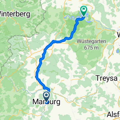
A cycling route starting in Marburg, Hesse, Germany.
Overview
About this route
Strecke zwischen Hessen und NRW;
Oberes Lahntal und Rothhaargebirge;
Quelle der Eder;
Viele Verbindungsmöglichkeiten schaffen Optionen für Abkürzungen;
ggf. 2-Tages-Tour mit zusätzlichen Abstechern im Rothaargebirge
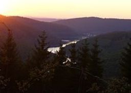
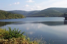
Die Obernautalsperre ist die größte Trinkwassertalsperre des Siegerlandes mit 15 Mio. Kubikmetern Fassungsvermögen.Sie
hat sich als Anziehungspunkt für Erholungssuchende aus nah und fern
herausgebildet. Eingebettet in die reizvolle Mittelgebirgslandschaft
wird sie überragt von der Alten Burg, einer Fliehburg und kultischer
Mittelpunkt aus der Zeit etwa 500 vor Christus.
Um die Obernautalsperre führt ein etwa 10 km langer asphaltierter
Rundweg, von dem sich dem Spaziergänger reizvolle Perspektiven auf die
Wasserflächen und die bewaldeten Hänge auftun. Der Rundweg ist geeignet
zum Wandern, Radfahren, Inlineskaten, Joggen und Nordic Walking.
- -:--
- Duration
- 139.1 km
- Distance
- 1,495 m
- Ascent
- 1,497 m
- Descent
- ---
- Avg. speed
- ---
- Max. altitude
created this 13 years ago
Route quality
Waytypes & surfaces along the route
Waytypes
Road
38.9 km
(28 %)
Quiet road
12.5 km
(9 %)
Surfaces
Paved
90.4 km
(65 %)
Unpaved
1.4 km
(1 %)
Asphalt
86.2 km
(62 %)
Paved (undefined)
4.2 km
(3 %)
Route highlights
Points of interest along the route

Point of interest after 69.1 km

Point of interest after 71.2 km
Continue with Bikemap
Use, edit, or download this cycling route
You would like to ride Cross Boarder Road Racing or customize it for your own trip? Here is what you can do with this Bikemap route:
Free features
- Save this route as favorite or in collections
- Copy & plan your own version of this route
- Split it into stages to create a multi-day tour
- Sync your route with Garmin or Wahoo
Premium features
Free trial for 3 days, or one-time payment. More about Bikemap Premium.
- Navigate this route on iOS & Android
- Export a GPX / KML file of this route
- Create your custom printout (try it for free)
- Download this route for offline navigation
Discover more Premium features.
Get Bikemap PremiumFrom our community
Other popular routes starting in Marburg
- Marburg-Lahn-Rhein-Hamburg
- 1997 Lahnradweg Marburg-Limburg
- 114.4 km
- 226 m
- 290 m
- Marburg, Hesse, Germany
- 2.Von Marburg bis Wetzlar (Lahn)
- 55 km
- 143 m
- 205 m
- Marburg, Hesse, Germany
- Durch die Lahnberge
- 13.6 km
- 308 m
- 309 m
- Marburg, Hesse, Germany
- Buchenrotsweg 19, Marburg nach Himbornstraße 18, Marburg
- 46.7 km
- 442 m
- 447 m
- Marburg, Hesse, Germany
- Reitgasse nach 52PJ+HR
- 67.2 km
- 890 m
- 849 m
- Marburg, Hesse, Germany
- Zum Stadtwald
- 17.9 km
- 175 m
- 298 m
- Marburg, Hesse, Germany
- Marburg-Wetzlar
- 63.5 km
- 188 m
- 212 m
- Marburg, Hesse, Germany
Open it in the app


