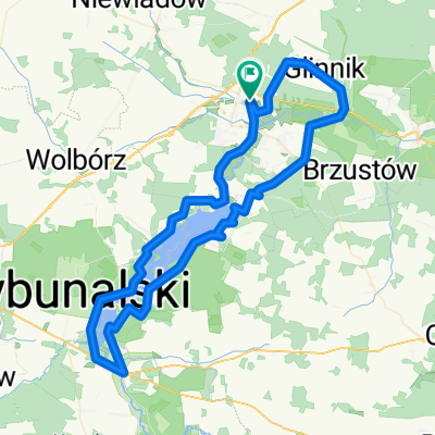
Tomaszow Maz. - Lodz
A cycling route starting in Tomasz贸w Mazowiecki, 艁贸d藕 Voivodeship, Poland.
Overview
About this route
A road from Tomaszow Maz. to Lodz, through local roads. Main goal was to avoid road 713 (high traffic).
- -:--
- Duration
- 67.3 km
- Distance
- 142 m
- Ascent
- 113 m
- Descent
- ---
- Avg. speed
- 215 m
- Max. altitude
Route quality
Waytypes & surfaces along the route
Waytypes
Road
35.7 km
(53 %)
Quiet road
8.7 km
(13 %)
Surfaces
Paved
35.7 km
(53 %)
Asphalt
35 km
(52 %)
Concrete
0.7 km
(1 %)
Undefined
31.6 km
(47 %)
Continue with Bikemap
Use, edit, or download this cycling route
You would like to ride Tomaszow Maz. - Lodz or customize it for your own trip? Here is what you can do with this Bikemap route:
Free features
- Save this route as favorite or in collections
- Copy & plan your own version of this route
- Sync your route with Garmin or Wahoo
Premium features
Free trial for 3 days, or one-time payment. More about Bikemap Premium.
- Navigate this route on iOS & Android
- Export a GPX / KML file of this route
- Create your custom printout (try it for free)
- Download this route for offline navigation
Discover more Premium features.
Get Bikemap PremiumFrom our community
Other popular routes starting in Tomasz贸w Mazowiecki
Rajd woko艂o zalewu sulejowskiego +dojazd z TM- Distance
- 66.3 km
- Ascent
- 182 m
- Descent
- 180 m
- Location
- Tomasz贸w Mazowiecki, 艁贸d藕 Voivodeship, Poland
around Zalew Sulejewski- Distance
- 55.9 km
- Ascent
- 216 m
- Descent
- 213 m
- Location
- Tomasz贸w Mazowiecki, 艁贸d藕 Voivodeship, Poland
Tomaszow Maz. - Lodz- Distance
- 67.3 km
- Ascent
- 142 m
- Descent
- 113 m
- Location
- Tomasz贸w Mazowiecki, 艁贸d藕 Voivodeship, Poland
TM-Inow艂贸dz-TM- Distance
- 36.4 km
- Ascent
- 99 m
- Descent
- 98 m
- Location
- Tomasz贸w Mazowiecki, 艁贸d藕 Voivodeship, Poland
Po obu stronach Gaci- Distance
- 100.2 km
- Ascent
- 501 m
- Descent
- 450 m
- Location
- Tomasz贸w Mazowiecki, 艁贸d藕 Voivodeship, Poland
2/3 p臋tli (zal. sulejowski - zal. patyki)- Distance
- 71 km
- Ascent
- 219 m
- Descent
- 186 m
- Location
- Tomasz贸w Mazowiecki, 艁贸d藕 Voivodeship, Poland
Smardzewice, Jele艅, Inow艂贸dz, Konewka- Distance
- 51.2 km
- Ascent
- 1,315 m
- Descent
- 1,325 m
- Location
- Tomasz贸w Mazowiecki, 艁贸d藕 Voivodeship, Poland
69 km wok贸艂 Zalewu Sulejowskiego- Distance
- 68.6 km
- Ascent
- 240 m
- Descent
- 236 m
- Location
- Tomasz贸w Mazowiecki, 艁贸d藕 Voivodeship, Poland
Open it in the app


