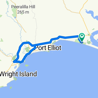
Murray Mouth
A cycling route starting in Goolwa, South Australia, Australia.
Overview
About this route
Leader: whoever
Moving Time: Approx 1hr 20 mins
Flat route on sealed roads. Coffee options at Hindmarsh Is. marina retirement village or showroom or tavern or at Cafelicious Goolwa.
- -:--
- Duration
- 29.2 km
- Distance
- 69 m
- Ascent
- 69 m
- Descent
- ---
- Avg. speed
- ---
- Avg. speed
Route quality
Waytypes & surfaces along the route
Waytypes
Quiet road
20.4 km
(70 %)
Access road
6.1 km
(21 %)
Surfaces
Paved
23.2 km
(79 %)
Asphalt
14.4 km
(49 %)
Paved (undefined)
8.8 km
(30 %)
Undefined
6 km
(21 %)
Continue with Bikemap
Use, edit, or download this cycling route
You would like to ride Murray Mouth or customize it for your own trip? Here is what you can do with this Bikemap route:
Free features
- Save this route as favorite or in collections
- Copy & plan your own version of this route
- Sync your route with Garmin or Wahoo
Premium features
Free trial for 3 days, or one-time payment. More about Bikemap Premium.
- Navigate this route on iOS & Android
- Export a GPX / KML file of this route
- Create your custom printout (try it for free)
- Download this route for offline navigation
Discover more Premium features.
Get Bikemap PremiumFrom our community
Other popular routes starting in Goolwa
- Murray Mouth
- Distance
- 29.2 km
- Ascent
- 69 m
- Descent
- 69 m
- Location
- Goolwa, South Australia, Australia
- Boats Planes Trains - Goolwa,Hindmarsh Is,Laffin Point, Airport Road,Middleton,Goolwa
- Distance
- 40.4 km
- Ascent
- 116 m
- Descent
- 119 m
- Location
- Goolwa, South Australia, Australia
- crows nest, hutchinson
- Distance
- 54.3 km
- Ascent
- 459 m
- Descent
- 460 m
- Location
- Goolwa, South Australia, Australia
- Skewes Currency Ck, Gould, Deep Ck, Frome part, Boettcher
- Distance
- 38.7 km
- Ascent
- 211 m
- Descent
- 212 m
- Location
- Goolwa, South Australia, Australia
- Goolwa Loop
- Distance
- 93.4 km
- Ascent
- 657 m
- Descent
- 643 m
- Location
- Goolwa, South Australia, Australia
- Goolwa loop 2
- Distance
- 42 km
- Ascent
- 166 m
- Descent
- 166 m
- Location
- Goolwa, South Australia, Australia
- Nangkita, Mt Compass, Tooperang
- Distance
- 61.6 km
- Ascent
- 320 m
- Descent
- 320 m
- Location
- Goolwa, South Australia, Australia
- Goolwa VH via Hindmarsh River
- Distance
- 45.3 km
- Ascent
- 147 m
- Descent
- 145 m
- Location
- Goolwa, South Australia, Australia
Open it in the app