

2012-09---7 bis 8-tage radtour in den pyrenaeen
A cycling route starting in Bagnères-de-Luchon, Occitanie, France.
Overview
About this route
bike tour with a tent.
mostly on asphalt.
a short gravel section at montgarri.
from luchon via loudnvielle, st. lary-soulan, aragnouet, bielsa, ainsa, el grado, estada, benabarre, tremp, sort, llavorsi, montgarri, salardu, vielha, bossost back to luchon.
- -:--
- Duration
- 489.2 km
- Distance
- 7,694 m
- Ascent
- 7,678 m
- Descent
- ---
- Avg. speed
- ---
- Max. altitude
Route highlights
Points of interest along the route
Point of interest after 18.7 km
col de peyresourde
Accommodation after 30.4 km
1. nacht campingplatz
Point of interest after 39.3 km
col d'azet
Accommodation after 58.5 km
2. nacht campingplatz
Point of interest after 69.4 km
tunel de aragnouet-bielsa, bocca nord
Accommodation after 128.6 km
3. nacht, camping sauvage
Accommodation after 177 km
4. nacht, campingplatz
Point of interest after 202.1 km
col
Point of interest after 212.7 km
col
Point of interest after 232.6 km
col
Accommodation after 254.8 km
5. nacht, campingplatz
Accommodation after 286.7 km
event weitere nacht auf campingplatz
Accommodation after 352.4 km
6. bzw. 7. nacht, camping sauvage
Point of interest after 408 km
col du portillion
Continue with Bikemap
Use, edit, or download this cycling route
You would like to ride 2012-09---7 bis 8-tage radtour in den pyrenaeen or customize it for your own trip? Here is what you can do with this Bikemap route:
Free features
- Save this route as favorite or in collections
- Copy & plan your own version of this route
- Split it into stages to create a multi-day tour
- Sync your route with Garmin or Wahoo
Premium features
Free trial for 3 days, or one-time payment. More about Bikemap Premium.
- Navigate this route on iOS & Android
- Export a GPX / KML file of this route
- Create your custom printout (try it for free)
- Download this route for offline navigation
Discover more Premium features.
Get Bikemap PremiumFrom our community
Other popular routes starting in Bagnères-de-Luchon
 Bagneres de Luchon-Col de Peyresourde-Col D´Aspin-Bagneres de Luchon
- Distance
- 160.4 km
- Ascent
- 2,395 m
- Descent
- 2,395 m
- Location
- Bagnères-de-Luchon, Occitanie, France
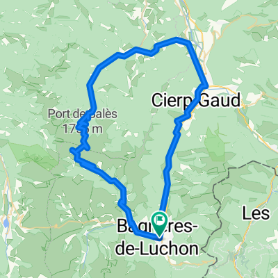 Bales
Bales- Distance
- 68.6 km
- Ascent
- 2,566 m
- Descent
- 2,566 m
- Location
- Bagnères-de-Luchon, Occitanie, France
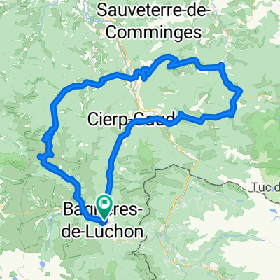 Bales - Mente - Ares
- Distance
- 115.2 km
- Ascent
- 4,824 m
- Descent
- 4,822 m
- Location
- Bagnères-de-Luchon, Occitanie, France
 2012-09---rundtour col d'ares+ col de mente
- Distance
- 63.3 km
- Ascent
- 1,330 m
- Descent
- 1,331 m
- Location
- Bagnères-de-Luchon, Occitanie, France
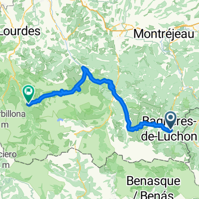
 Bagnères-de-Luchon - Tarascon-sur-Ariège 2
- Distance
- 197.9 km
- Ascent
- 4,111 m
- Descent
- 4,268 m
- Location
- Bagnères-de-Luchon, Occitanie, France
 2012-09---7 bis 8-tage radtour in den pyrenaeen
- Distance
- 489.2 km
- Ascent
- 7,694 m
- Descent
- 7,678 m
- Location
- Bagnères-de-Luchon, Occitanie, France
 Stage 17 Tour de France 2012 from Bagnères-de-Luchon to Peyragudes
- Distance
- 148.1 km
- Ascent
- 3,244 m
- Descent
- 2,278 m
- Location
- Bagnères-de-Luchon, Occitanie, France
 1ª Etapa Pirineos 2015 - Peyresourde, Aspin, Tourmalet.
- Distance
- 99.7 km
- Ascent
- 2,945 m
- Descent
- 2,865 m
- Location
- Bagnères-de-Luchon, Occitanie, France
Open it in the app