

Parklands MTB Park Long Circuit
A cycling route starting in Twin Waters, Queensland, Australia.
Overview
About this route
Embark on an exhilarating e-MTB adventure at Parklands MTB Park, starting from the Radar Hill carpark entrance. Begin your ride on the Shared Link trail, leading you onto the challenging CT track, where the terrain starts to test your skills. From there, transition onto the Rocky Creek Circuit, known for its technical sections and beautiful natural surroundings. As you continue, take on the Rocknroll track, a favourite for its flowy descents and thrilling twists. Next, the Lemon Tree/Komine track offers a mix of climbs and descents, keeping the ride dynamic and engaging. Finally, finish your loop on the Ho Chi Hoe track, leading you back to the Radar Hill carpark with a sense of accomplishment and adrenaline. This route offers a perfect blend of technical challenges and scenic beauty, making it a must-do for e-MTB enthusiasts.
- 1 h 42 min
- Duration
- 8 km
- Distance
- 263 m
- Ascent
- 264 m
- Descent
- 4.7 km/h
- Avg. speed
- 158 m
- Max. altitude

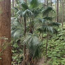
Route photos

Route quality
Waytypes & surfaces along the route
Waytypes
Path
6.7 km
(83 %)
Track
1.4 km
(17 %)
Surfaces
Unpaved
4.5 km
(56 %)
Unpaved (undefined)
4.2 km
(52 %)
Ground
0.3 km
(4 %)
Undefined
3.5 km
(44 %)
Continue with Bikemap
Use, edit, or download this cycling route
You would like to ride Parklands MTB Park Long Circuit or customize it for your own trip? Here is what you can do with this Bikemap route:
Free features
- Save this route as favorite or in collections
- Copy & plan your own version of this route
- Sync your route with Garmin or Wahoo
Premium features
Free trial for 3 days, or one-time payment. More about Bikemap Premium.
- Navigate this route on iOS & Android
- Export a GPX / KML file of this route
- Create your custom printout (try it for free)
- Download this route for offline navigation
Discover more Premium features.
Get Bikemap PremiumFrom our community
Other popular routes starting in Twin Waters
 Radar Hill Road, Kulangoor to Radar Hill Road, Kulangoor
- Distance
- 5.9 km
- Ascent
- 51 m
- Descent
- 56 m
- Location
- Twin Waters, Queensland, Australia
 Nambour Connection Road 1106, Parklands to Lawrence Street 58, Gympie
- Distance
- 70.7 km
- Ascent
- 1,250 m
- Descent
- 1,220 m
- Location
- Twin Waters, Queensland, Australia
 Parklands Friday Moring e-MTB'ing
- Distance
- 9.3 km
- Ascent
- 309 m
- Descent
- 309 m
- Location
- Twin Waters, Queensland, Australia
 State Route 6 255, Bli Bli to Nudgee Road 601, Nundah
- Distance
- 93.2 km
- Ascent
- 0 m
- Descent
- 14 m
- Location
- Twin Waters, Queensland, Australia
 2 Lake View Pl, Bli Bli to 2 Lake View Pl, Bli Bli
- Distance
- 25.4 km
- Ascent
- 232 m
- Descent
- 239 m
- Location
- Twin Waters, Queensland, Australia
 Maroochy River to Noosa
- Distance
- 35.6 km
- Ascent
- 367 m
- Descent
- 367 m
- Location
- Twin Waters, Queensland, Australia
 Valdora to Noosa Heads
- Distance
- 33.5 km
- Ascent
- 332 m
- Descent
- 327 m
- Location
- Twin Waters, Queensland, Australia
 Valdora to Mudjimba
- Distance
- 37.9 km
- Ascent
- 322 m
- Descent
- 316 m
- Location
- Twin Waters, Queensland, Australia
Open it in the app