

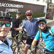
tuxtla
A cycling route starting in Copoya, Chiapas, Mexico.
Overview
About this route
- -:--
- Duration
- 85.9 km
- Distance
- 973 m
- Ascent
- 1,414 m
- Descent
- ---
- Avg. speed
- ---
- Max. altitude
Continue with Bikemap
Use, edit, or download this cycling route
You would like to ride tuxtla or customize it for your own trip? Here is what you can do with this Bikemap route:
Free features
- Save this route as favorite or in collections
- Copy & plan your own version of this route
- Split it into stages to create a multi-day tour
- Sync your route with Garmin or Wahoo
Premium features
Free trial for 3 days, or one-time payment. More about Bikemap Premium.
- Navigate this route on iOS & Android
- Export a GPX / KML file of this route
- Create your custom printout (try it for free)
- Download this route for offline navigation
Discover more Premium features.
Get Bikemap PremiumFrom our community
Other popular routes starting in Copoya
 De Calle 2 21, Tuxtla Gutiérrez a Sándalo Norte 404A, Tuxtla Gutiérrez
- Distance
- 15.4 km
- Ascent
- 61 m
- Descent
- 115 m
- Location
- Copoya, Chiapas, Mexico
 Cereza del pastel
- Distance
- 25.5 km
- Ascent
- 912 m
- Descent
- 934 m
- Location
- Copoya, Chiapas, Mexico
 Recovered Route
- Distance
- 21 km
- Ascent
- 71 m
- Descent
- 126 m
- Location
- Copoya, Chiapas, Mexico
 san miguel campo de tiro piedra santa. san miguel
- Distance
- 4.2 km
- Ascent
- 41 m
- Descent
- 42 m
- Location
- Copoya, Chiapas, Mexico
 De De La Lanza, Tuxtla Gutiérrez a Cerrada 14a. Poniente Sur 1374, Tuxtla Gutiérrez
- Distance
- 14.8 km
- Ascent
- 222 m
- Descent
- 182 m
- Location
- Copoya, Chiapas, Mexico
 tuxtla
- Distance
- 85.9 km
- Ascent
- 973 m
- Descent
- 1,414 m
- Location
- Copoya, Chiapas, Mexico
 De Séptima Oriente Norte 6, El Jobo a Pedregal 114, Tuxtla Gutiérrez
- Distance
- 5.6 km
- Ascent
- 11 m
- Descent
- 275 m
- Location
- Copoya, Chiapas, Mexico
 Ruta deportiva en Chiapa de Corzo
- Distance
- 18.7 km
- Ascent
- 94 m
- Descent
- 180 m
- Location
- Copoya, Chiapas, Mexico
Open it in the app