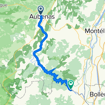
Parcours autour d'Aubenas
A cycling route starting in Aubenas, Auvergne-Rhône-Alpes, France.
Overview
About this route
26 cols around Aubenas for obtaining the BERTHA, the Exceptional Brevet for Titanesque and Homeric Randonneur of Ardèche.
- -:--
- Duration
- 165.6 km
- Distance
- 2,266 m
- Ascent
- 2,266 m
- Descent
- ---
- Avg. speed
- ---
- Max. altitude
Route quality
Waytypes & surfaces along the route
Waytypes
Road
79.5 km
(48 %)
Quiet road
19.9 km
(12 %)
Surfaces
Paved
66.2 km
(40 %)
Asphalt
62.9 km
(38 %)
Paved (undefined)
3.3 km
(2 %)
Undefined
99.4 km
(60 %)
Route highlights
Points of interest along the route
Point of interest after 6.6 km
Col d'Autuche 327m
Point of interest after 10.2 km
Col de Vals 402m
Point of interest after 13.3 km
Col de Montagnac 558m
Point of interest after 20.2 km
Col de Conchis 694m
Point of interest after 21.4 km
Col de Genestelle 648m
Point of interest after 31.8 km
Col d'Aizac 642m
Point of interest after 38.1 km
Col de Juvinas 718m
Point of interest after 46.4 km
Col de Moucheyre 858m
Point of interest after 66.6 km
Col du Pranlet 1363m
Point of interest after 75.3 km
Col de Mezilhac 1119m
Point of interest after 81.5 km
Col des Quatre Vios 1149m
Point of interest after 88.3 km
Col de Miraud 986m
Point of interest after 89.5 km
Malpas 1074m
Point of interest after 94.1 km
Col de la Fayolle 877m
Point of interest after 95.3 km
Goulet de Peyrille 832m
Point of interest after 99.5 km
Col de Sarrasset 825m
Point of interest after 103.5 km
Col des Pierres de Faux 793m
Point of interest after 107.7 km
Col de l'Arénier 682m
Point of interest after 109.8 km
Col de l'Escrinet 787m
Point of interest after 114.4 km
Coulet de la Souliere 834m
Point of interest after 118.6 km
Col du Benas 795m
Point of interest after 123.8 km
Col de Fontenelle 703m
Point of interest after 125 km
Col Saint Martin 723m
Point of interest after 140.3 km
Pas de Vendrias 635m
Point of interest after 152.5 km
Col de Valaurie
Point of interest after 155 km
Col d'Auriolles
Continue with Bikemap
Use, edit, or download this cycling route
You would like to ride Parcours autour d'Aubenas or customize it for your own trip? Here is what you can do with this Bikemap route:
Free features
- Save this route as favorite or in collections
- Copy & plan your own version of this route
- Split it into stages to create a multi-day tour
- Sync your route with Garmin or Wahoo
Premium features
Free trial for 3 days, or one-time payment. More about Bikemap Premium.
- Navigate this route on iOS & Android
- Export a GPX / KML file of this route
- Create your custom printout (try it for free)
- Download this route for offline navigation
Discover more Premium features.
Get Bikemap PremiumFrom our community
Other popular routes starting in Aubenas
 Raid 707 - Section 6
- Distance
- 100.9 km
- Ascent
- 841 m
- Descent
- 944 m
- Location
- Aubenas, Auvergne-Rhône-Alpes, France
 Cévennes V3
- Distance
- 482.7 km
- Ascent
- 5,608 m
- Descent
- 5,610 m
- Location
- Aubenas, Auvergne-Rhône-Alpes, France
 Parcours autour d'Aubenas
- Distance
- 165.6 km
- Ascent
- 2,266 m
- Descent
- 2,266 m
- Location
- Aubenas, Auvergne-Rhône-Alpes, France
 COP' Aventure 2014 - 4ème étape
- Distance
- 89 km
- Ascent
- 1,409 m
- Descent
- 1,415 m
- Location
- Aubenas, Auvergne-Rhône-Alpes, France
 AUBENAS-AUBENAS
- Distance
- 92.1 km
- Ascent
- 1,641 m
- Descent
- 1,623 m
- Location
- Aubenas, Auvergne-Rhône-Alpes, France
 Ardèche_Aubenas - St. Remèze
- Distance
- 56.2 km
- Ascent
- 1,107 m
- Descent
- 952 m
- Location
- Aubenas, Auvergne-Rhône-Alpes, France
 2023 Ardèche Aubenas-Stes Maries de la Mer
- Distance
- 748.1 km
- Ascent
- 7,646 m
- Descent
- 7,962 m
- Location
- Aubenas, Auvergne-Rhône-Alpes, France
 2010.1 Aubenas-Saint-Martin-d'Ardèche
- Distance
- 70.2 km
- Ascent
- 1,153 m
- Descent
- 1,366 m
- Location
- Aubenas, Auvergne-Rhône-Alpes, France
Open it in the app

