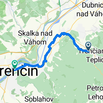
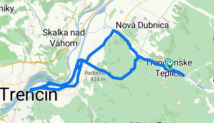
Trenčianske Teplice , Trenčín a späť.
A cycling route starting in Trenčianske Teplice, Nitra Region, Slovakia.
Overview
About this route
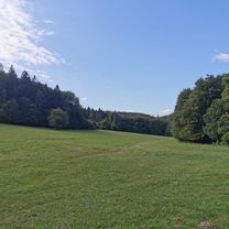
V prvej tretine je to trocha náročnejšie jazda lesom trocha náročnejšia ale v pohode sa dá prejsť . A ostatok je už viac menej jazda po asfalte.
- 2 h 59 min
- Duration
- 30.5 km
- Distance
- 333 m
- Ascent
- 371 m
- Descent
- 10.2 km/h
- Avg. speed
- 370 m
- Max. altitude
Route photos
Route quality
Waytypes & surfaces along the route
Waytypes
Quiet road
11.9 km
(39 %)
Cycleway
4.3 km
(14 %)
Surfaces
Paved
21.6 km
(71 %)
Unpaved
4.3 km
(14 %)
Asphalt
21.6 km
(71 %)
Gravel
1.8 km
(6 %)
Continue with Bikemap
Use, edit, or download this cycling route
You would like to ride Trenčianske Teplice , Trenčín a späť. or customize it for your own trip? Here is what you can do with this Bikemap route:
Free features
- Save this route as favorite or in collections
- Copy & plan your own version of this route
- Sync your route with Garmin or Wahoo
Premium features
Free trial for 3 days, or one-time payment. More about Bikemap Premium.
- Navigate this route on iOS & Android
- Export a GPX / KML file of this route
- Create your custom printout (try it for free)
- Download this route for offline navigation
Discover more Premium features.
Get Bikemap PremiumFrom our community
Other popular routes starting in Trenčianske Teplice
Homôlka-Zliechov-Mojtín-Košecké Podhradie-Iliavka-Dubnica.- Distance
- 51.6 km
- Ascent
- 1,770 m
- Descent
- 2,164 m
- Location
- Trenčianske Teplice, Nitra Region, Slovakia
Trenč.Teplice-Trenč.Teplá - Nemšová- Distance
- 11.2 km
- Ascent
- 13 m
- Descent
- 57 m
- Location
- Trenčianske Teplice, Nitra Region, Slovakia
Čierna Lehota - hrad Čierna Lehota - Baske - Omšenie- Distance
- 13.1 km
- Ascent
- 704 m
- Descent
- 780 m
- Location
- Trenčianske Teplice, Nitra Region, Slovakia
Trenčianske Teplice - Motešice - Bobot- Distance
- 13 km
- Ascent
- 203 m
- Descent
- 239 m
- Location
- Trenčianske Teplice, Nitra Region, Slovakia
Trenčianske Teplice Radfahren- Distance
- 42.1 km
- Ascent
- 560 m
- Descent
- 558 m
- Location
- Trenčianske Teplice, Nitra Region, Slovakia
Trenčianske Teplice , Trenčín a späť.- Distance
- 30.5 km
- Ascent
- 333 m
- Descent
- 371 m
- Location
- Trenčianske Teplice, Nitra Region, Slovakia
Tr. Teplice-Dolna Poruba-Homolka a spat- Distance
- 39.7 km
- Ascent
- 759 m
- Descent
- 759 m
- Location
- Trenčianske Teplice, Nitra Region, Slovakia
Tren. Teplice-TN-Lucky-Machnac-Baske-Tren. Teplice- Distance
- 52.3 km
- Ascent
- 1,080 m
- Descent
- 1,080 m
- Location
- Trenčianske Teplice, Nitra Region, Slovakia
Open it in the app


