

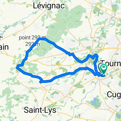
De Plaisance-du-Touch à la gare de Muret
A cycling route starting in Plaisance-du-Touch, Occitanie, France.
Overview
About this route
I was looking for a way to reach Muret while avoiding cars. In the end, the route is not 100% green: there are still many roads (even if they are little used), crossings of towns without bike lanes, and the industrial or commercial zones are not very appealing to me. This route does not aim for tourism in itself but rather the connection to bike paths south of Muret. For leisure, one can note the gravel pits between Plaisance and Frouzins and those between Frouzins and Roques.
- -:--
- Duration
- 18 km
- Distance
- 20 m
- Ascent
- 17 m
- Descent
- ---
- Avg. speed
- ---
- Max. altitude
Route quality
Waytypes & surfaces along the route
Waytypes
Quiet road
11.7 km
(65 %)
Track
2.2 km
(12 %)
Surfaces
Paved
6.6 km
(37 %)
Unpaved
0.5 km
(3 %)
Asphalt
6.6 km
(37 %)
Gravel
0.5 km
(3 %)
Undefined
10.8 km
(60 %)
Continue with Bikemap
Use, edit, or download this cycling route
You would like to ride De Plaisance-du-Touch à la gare de Muret or customize it for your own trip? Here is what you can do with this Bikemap route:
Free features
- Save this route as favorite or in collections
- Copy & plan your own version of this route
- Sync your route with Garmin or Wahoo
Premium features
Free trial for 3 days, or one-time payment. More about Bikemap Premium.
- Navigate this route on iOS & Android
- Export a GPX / KML file of this route
- Create your custom printout (try it for free)
- Download this route for offline navigation
Discover more Premium features.
Get Bikemap PremiumFrom our community
Other popular routes starting in Plaisance-du-Touch
 Rue Chateaubriand, Plaisance-du-Touch à Rue d'Estujats, Plaisance-du-Touch
- Distance
- 40.8 km
- Ascent
- 514 m
- Descent
- 514 m
- Location
- Plaisance-du-Touch, Occitanie, France
 27/05/2020
- Distance
- 94.1 km
- Ascent
- 405 m
- Descent
- 401 m
- Location
- Plaisance-du-Touch, Occitanie, France
 Boucle au départ de Plaisance du Touch
- Distance
- 47.3 km
- Ascent
- 290 m
- Descent
- 291 m
- Location
- Plaisance-du-Touch, Occitanie, France
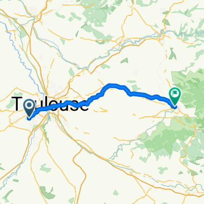
 De Rue Monestié 14, Plaisance-du-Touch à Chemin de Basso Cambo 146, Toulouse
- Distance
- 10.3 km
- Ascent
- 5 m
- Descent
- 56 m
- Location
- Plaisance-du-Touch, Occitanie, France
 De 2 Impasse du Pigeonnier, Plaisance-du-Touch à Chemin de Vallette-Bas, Tournefeuille
- Distance
- 2.6 km
- Ascent
- 0 m
- Descent
- 0 m
- Location
- Plaisance-du-Touch, Occitanie, France
 Itinéraire vers Avenue des Arènes Romaines, Toulouse
- Distance
- 11.8 km
- Ascent
- 165 m
- Descent
- 181 m
- Location
- Plaisance-du-Touch, Occitanie, France
 Forêt de Boucone
- Distance
- 26.3 km
- Ascent
- 104 m
- Descent
- 122 m
- Location
- Plaisance-du-Touch, Occitanie, France
 De Rue Monestié 14, Plaisance-du-Touch à Chemin de Basso Cambo 146, Toulouse
- Distance
- 10.5 km
- Ascent
- 4 m
- Descent
- 7 m
- Location
- Plaisance-du-Touch, Occitanie, France
Open it in the app