

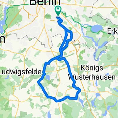
Berlin - Köln
A cycling route starting in Plänterwald, Land Berlin, Germany.
Overview
About this route
Diese Strecke wird erst im Sommer 2012 befahren. Nach dieser Tour kommen dann mehr Infos zu strande
- -:--
- Duration
- 627.8 km
- Distance
- 1,595 m
- Ascent
- 1,549 m
- Descent
- ---
- Avg. speed
- ---
- Max. altitude
Route quality
Waytypes & surfaces along the route
Waytypes
Busy road
309.4 km
(49 %)
Path
99.4 km
(16 %)
Surfaces
Paved
492.4 km
(78 %)
Unpaved
30.8 km
(5 %)
Asphalt
433.1 km
(69 %)
Paving stones
44.3 km
(7 %)
Continue with Bikemap
Use, edit, or download this cycling route
You would like to ride Berlin - Köln or customize it for your own trip? Here is what you can do with this Bikemap route:
Free features
- Save this route as favorite or in collections
- Copy & plan your own version of this route
- Split it into stages to create a multi-day tour
- Sync your route with Garmin or Wahoo
Premium features
Free trial for 3 days, or one-time payment. More about Bikemap Premium.
- Navigate this route on iOS & Android
- Export a GPX / KML file of this route
- Create your custom printout (try it for free)
- Download this route for offline navigation
Discover more Premium features.
Get Bikemap PremiumFrom our community
Other popular routes starting in Plänterwald
 Lasso-Runde
- Distance
- 91.9 km
- Ascent
- 118 m
- Descent
- 118 m
- Location
- Plänterwald, Land Berlin, Germany
 Berlin - Diedersdorf - Löwenbruch - Blankenfelde - Waßmannsdorf - Berlin
- Distance
- 96.3 km
- Ascent
- 87 m
- Descent
- 87 m
- Location
- Plänterwald, Land Berlin, Germany
 Rixdorf, Müggelsee, durch den Forst zurück CLONED FROM ROUTE 241450
- Distance
- 45.8 km
- Ascent
- 67 m
- Descent
- 77 m
- Location
- Plänterwald, Land Berlin, Germany
 Rund um West-Berlin (Mauerweg RR)
- Distance
- 139.9 km
- Ascent
- 190 m
- Descent
- 185 m
- Location
- Plänterwald, Land Berlin, Germany
 Feierabendrunde_Neukölln_Schönefeld
- Distance
- 38.7 km
- Ascent
- 47 m
- Descent
- 46 m
- Location
- Plänterwald, Land Berlin, Germany
 Sonnenallee-Dahlewitz-Blankenfelde-Sonnenallee
- Distance
- 60.6 km
- Ascent
- 52 m
- Descent
- 53 m
- Location
- Plänterwald, Land Berlin, Germany
 Südostrunde 90 km
- Distance
- 89.8 km
- Ascent
- 196 m
- Descent
- 187 m
- Location
- Plänterwald, Land Berlin, Germany
 Rund um West-Berlin (Mauerweg RR)
- Distance
- 139.7 km
- Ascent
- 335 m
- Descent
- 332 m
- Location
- Plänterwald, Land Berlin, Germany
Open it in the app