

Częstochowa - Kusięta - Srocko - Mstów
A cycling route starting in Częstochowa, Silesian Voivodeship, Poland.
Overview
About this route
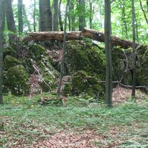
The ride from the karst lake in Kusięty northward towards Srock is practically impossible without getting your feet wet :) After pushing through flooded terrain and forest, you'll face an urban/rural jungle in Srock - no passage - only big angry dogs because someone approached their house from behind. I didn't find a way between the houses, and no homeowner was around to allow passage through their yard.
- -:--
- Duration
- 39.8 km
- Distance
- 208 m
- Ascent
- 215 m
- Descent
- ---
- Avg. speed
- ---
- Max. altitude
Continue with Bikemap
Use, edit, or download this cycling route
You would like to ride Częstochowa - Kusięta - Srocko - Mstów or customize it for your own trip? Here is what you can do with this Bikemap route:
Free features
- Save this route as favorite or in collections
- Copy & plan your own version of this route
- Sync your route with Garmin or Wahoo
Premium features
Free trial for 3 days, or one-time payment. More about Bikemap Premium.
- Navigate this route on iOS & Android
- Export a GPX / KML file of this route
- Create your custom printout (try it for free)
- Download this route for offline navigation
Discover more Premium features.
Get Bikemap PremiumFrom our community
Other popular routes starting in Częstochowa
 Jurajski Szlak Rowerowy Orlich Gniazd
- Distance
- 177.7 km
- Ascent
- 766 m
- Descent
- 798 m
- Location
- Częstochowa, Silesian Voivodeship, Poland
 Czestochowa-Dubrovnik
- Distance
- 1,358.7 km
- Ascent
- 2,201 m
- Descent
- 2,399 m
- Location
- Częstochowa, Silesian Voivodeship, Poland
 Murów,Srocko,Kusięta,Olsztyn,Częstochowa
- Distance
- 39.7 km
- Ascent
- 216 m
- Descent
- 209 m
- Location
- Częstochowa, Silesian Voivodeship, Poland
 SOGp
SOGp- Distance
- 157.2 km
- Ascent
- 586 m
- Descent
- 623 m
- Location
- Częstochowa, Silesian Voivodeship, Poland
 Mirów
Mirów- Distance
- 39.4 km
- Ascent
- 106 m
- Descent
- 103 m
- Location
- Częstochowa, Silesian Voivodeship, Poland
 Częstochowa - Olsztyn - Słowik - Częstochowa
- Distance
- 50.4 km
- Ascent
- 176 m
- Descent
- 176 m
- Location
- Częstochowa, Silesian Voivodeship, Poland
 Częstochowa - Folwark Kamyk - Częstochowa 26,2 km
- Distance
- 26.2 km
- Ascent
- 86 m
- Descent
- 86 m
- Location
- Częstochowa, Silesian Voivodeship, Poland
 Po Jurze
- Distance
- 59.2 km
- Ascent
- 221 m
- Descent
- 220 m
- Location
- Częstochowa, Silesian Voivodeship, Poland
Open it in the app