

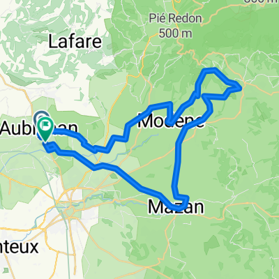
Gorge de la nesque - Chatelet Mt. Ventoux
A cycling route starting in Aubignan, Provence-Alpes-Côte d'Azur Region, France.
Overview
About this route
Schöne Tour durch die Gorge de da la nesque
- -:--
- Duration
- 101.5 km
- Distance
- 1,518 m
- Ascent
- 1,515 m
- Descent
- ---
- Avg. speed
- ---
- Max. altitude

Route quality
Waytypes & surfaces along the route
Waytypes
Road
34.5 km
(34 %)
Quiet road
8.1 km
(8 %)
Surfaces
Paved
84.2 km
(83 %)
Asphalt
84.2 km
(83 %)
Undefined
17.3 km
(17 %)
Continue with Bikemap
Use, edit, or download this cycling route
You would like to ride Gorge de la nesque - Chatelet Mt. Ventoux or customize it for your own trip? Here is what you can do with this Bikemap route:
Free features
- Save this route as favorite or in collections
- Copy & plan your own version of this route
- Split it into stages to create a multi-day tour
- Sync your route with Garmin or Wahoo
Premium features
Free trial for 3 days, or one-time payment. More about Bikemap Premium.
- Navigate this route on iOS & Android
- Export a GPX / KML file of this route
- Create your custom printout (try it for free)
- Download this route for offline navigation
Discover more Premium features.
Get Bikemap PremiumFrom our community
Other popular routes starting in Aubignan
 Rit met Rita
- Distance
- 35.4 km
- Ascent
- 131 m
- Descent
- 167 m
- Location
- Aubignan, Provence-Alpes-Côte d'Azur Region, France
 Aubignan Gorges de la Nesque Col des Abeilles
- Distance
- 85.7 km
- Ascent
- 1,954 m
- Descent
- 1,804 m
- Location
- Aubignan, Provence-Alpes-Côte d'Azur Region, France
 Hotellet - Mont Ventoux
- Distance
- 36.6 km
- Ascent
- 1,835 m
- Descent
- 6 m
- Location
- Aubignan, Provence-Alpes-Côte d'Azur Region, France
 Maxpulse - TdF - Mont Ventoux
- Distance
- 69 km
- Ascent
- 1,843 m
- Descent
- 1,838 m
- Location
- Aubignan, Provence-Alpes-Côte d'Azur Region, France
 Les Gorges du Nesque
- Distance
- 92.6 km
- Ascent
- 1,373 m
- Descent
- 1,383 m
- Location
- Aubignan, Provence-Alpes-Côte d'Azur Region, France
 Aubignan Bedoin Ockersteinbrüche 43km
- Distance
- 42.6 km
- Ascent
- 412 m
- Descent
- 411 m
- Location
- Aubignan, Provence-Alpes-Côte d'Azur Region, France
 Carpentras
- Distance
- 35.8 km
- Ascent
- 8 m
- Descent
- 0 m
- Location
- Aubignan, Provence-Alpes-Côte d'Azur Region, France
 Aubignan-Bedoin-Mt. Ventoux-Malaucene-Le Barroux-Lafare-Aubignan
- Distance
- 77.5 km
- Ascent
- 1,943 m
- Descent
- 1,932 m
- Location
- Aubignan, Provence-Alpes-Côte d'Azur Region, France
Open it in the app