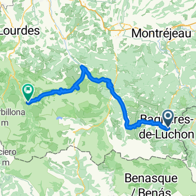
Superbagnères - Portillon
- 56.6 km
- 2,600 m
- 2,602 m
- Bagnères-de-Luchon, Occitanie, France
A cycling route starting in Bagnères-de-Luchon, Occitanie, France.
Overview
Steep climb and descent at Port de Balès. The road there is sometimes very narrow.
created this 13 years ago
Route quality
Road
5.8 km
(8 %)
Quiet road
2.2 km
(3 %)
Paved
54.7 km
(75 %)
Unpaved
2.2 km
(3 %)
Asphalt
54.7 km
(75 %)
Unpaved (undefined)
2.2 km
(3 %)
Undefined
16.1 km
(22 %)
Route highlights
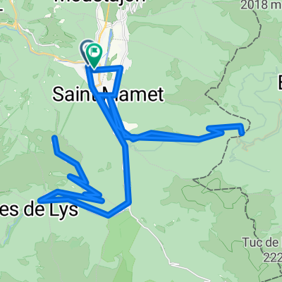
port de balès
Continue with Bikemap
You would like to ride 2012-09---rundtour luchon - mauleon-barousse - port de balès - luchon or customize it for your own trip? Here is what you can do with this Bikemap route:
Free trial for 3 days, or one-time payment. More about Bikemap Premium.
Discover more Premium features.
Get Bikemap PremiumFrom our community
Open it in the app