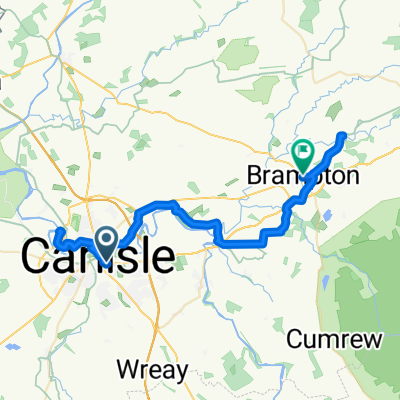
DAY 6 / 9 - Carlisle - Paisley
A cycling route starting in Carlisle, England, United Kingdom.
Overview
About this route
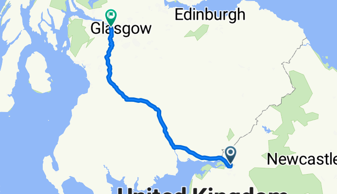
<h3 class="blue flushTop" style="font-size: 1.5em; margin-top: 0px; margin-right: 0px; margin-bottom: 10px; margin-left: 0px; color: #006fad; font-family: Arial, Helvetica, sans-serif; text-align: left;">Travelodge Glasgow</h3> <div class="fl" style="float: left; color: #09123e; font-family: Arial, Helvetica, sans-serif; font-size: 12px; text-align: left;">
150 Kings Inch Road<br />Renfrew<br />PA4 8ZL </div>
- -:--
- Duration
- 180 km
- Distance
- 555 m
- Ascent
- 575 m
- Descent
- ---
- Avg. speed
- ---
- Max. altitude
Continue with Bikemap
Use, edit, or download this cycling route
You would like to ride DAY 6 / 9 - Carlisle - Paisley or customize it for your own trip? Here is what you can do with this Bikemap route:
Free features
- Save this route as favorite or in collections
- Copy & plan your own version of this route
- Split it into stages to create a multi-day tour
- Sync your route with Garmin or Wahoo
Premium features
Free trial for 3 days, or one-time payment. More about Bikemap Premium.
- Navigate this route on iOS & Android
- Export a GPX / KML file of this route
- Create your custom printout (try it for free)
- Download this route for offline navigation
Discover more Premium features.
Get Bikemap PremiumFrom our community
Other popular routes starting in Carlisle
- Day 3 strict
- Distance
- 55.4 km
- Ascent
- 662 m
- Descent
- 475 m
- Location
- Carlisle, England, United Kingdom
- Day 4.5 - Carlisle to Dunkeld
- Distance
- 251.2 km
- Ascent
- 896 m
- Descent
- 840 m
- Location
- Carlisle, England, United Kingdom
- Untitled route
- Distance
- 104.4 km
- Ascent
- 1,057 m
- Descent
- 973 m
- Location
- Carlisle, England, United Kingdom
- Currock2Wreay2Durdar - OR
- Distance
- 15.6 km
- Ascent
- 104 m
- Descent
- 105 m
- Location
- Carlisle, England, United Kingdom
- Day 7, 78 miles from Carlyle to Lancaster
- Distance
- 124.9 km
- Ascent
- 1,361 m
- Descent
- 1,337 m
- Location
- Carlisle, England, United Kingdom
- Untitled route
- Distance
- 52.1 km
- Ascent
- 506 m
- Descent
- 446 m
- Location
- Carlisle, England, United Kingdom
- Kingstown Road 42 to Kingstown Road 49
- Distance
- 33 km
- Ascent
- 272 m
- Descent
- 271 m
- Location
- Carlisle, England, United Kingdom
- Girolibero: Il vallo di Adriano e il Lake District
- Distance
- 352 km
- Ascent
- 2,037 m
- Descent
- 2,047 m
- Location
- Carlisle, England, United Kingdom
Open it in the app