

Eps.1
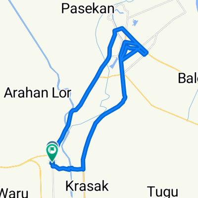
A cycling route starting in Jatibarang, West Java, Indonesia.
Overview
About this route
- 1 h 10 min
- Duration
- 18.7 km
- Distance
- 21 m
- Ascent
- 41 m
- Descent
- 16.1 km/h
- Avg. speed
- 35 m
- Max. altitude

Route photos

Route quality
Waytypes & surfaces along the route
Waytypes
Quiet road
10.5 km
(56 %)
Undefined
8.2 km
(44 %)
Continue with Bikemap
Use, edit, or download this cycling route
You would like to ride Eps.1 or customize it for your own trip? Here is what you can do with this Bikemap route:
Free features
- Save this route as favorite or in collections
- Copy & plan your own version of this route
- Sync your route with Garmin or Wahoo
Premium features
Free trial for 3 days, or one-time payment. More about Bikemap Premium.
- Navigate this route on iOS & Android
- Export a GPX / KML file of this route
- Create your custom printout (try it for free)
- Download this route for offline navigation
Discover more Premium features.
Get Bikemap PremiumFrom our community
Other popular routes starting in Jatibarang
 Route to Jalan Raya Lohbener No.36
- Distance
- 31.1 km
- Ascent
- 319 m
- Descent
- 324 m
- Location
- Jatibarang, West Java, Indonesia
 Legok, Kecamatan Lohbener to Unnamed Road, Lohbener
- Distance
- 9.5 km
- Ascent
- 8 m
- Descent
- 4 m
- Location
- Jatibarang, West Java, Indonesia
 Jalan Raya Lohbener 60, Kecamatan Lohbener to Jalan Raya Lohbener 60, Kecamatan Lohbener
- Distance
- 12.6 km
- Ascent
- 106 m
- Descent
- 97 m
- Location
- Jatibarang, West Java, Indonesia
 Eps.1
Eps.1- Distance
- 18.7 km
- Ascent
- 21 m
- Descent
- 41 m
- Location
- Jatibarang, West Java, Indonesia
 Jalan Letnan Joni No.180, Kecamatan Jatibarang to Jalan Raya Bangodua
- Distance
- 15.8 km
- Ascent
- 5 m
- Descent
- 0 m
- Location
- Jatibarang, West Java, Indonesia
 Losarang Slawi Jalur Alt
- Distance
- 156.2 km
- Ascent
- 276 m
- Descent
- 241 m
- Location
- Jatibarang, West Java, Indonesia
 Jalan Raya Lohbener 60, Kecamatan Lohbener to Unnamed Road, Lohbener
- Distance
- 11.9 km
- Ascent
- 58 m
- Descent
- 54 m
- Location
- Jatibarang, West Java, Indonesia
 Unnamed Road, Widasari to Unnamed Road, Haurgeulis
- Distance
- 42.2 km
- Ascent
- 241 m
- Descent
- 224 m
- Location
- Jatibarang, West Java, Indonesia
Open it in the app