

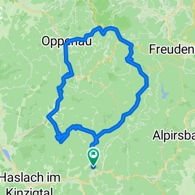
BF24-04 Oberwolfach - Sulz a. Neckar - 108 KM
A cycling route starting in Oberwolfach, Baden-Wurttemberg, Germany.
Overview
About this route
- -:--
- Duration
- 107.7 km
- Distance
- 1,503 m
- Ascent
- 1,502 m
- Descent
- ---
- Avg. speed
- 858 m
- Max. altitude

Route quality
Waytypes & surfaces along the route
Waytypes
Track
34.5 km
(32 %)
Quiet road
23.7 km
(22 %)
Surfaces
Paved
71.1 km
(66 %)
Unpaved
20.5 km
(19 %)
Asphalt
62.5 km
(58 %)
Gravel
18.3 km
(17 %)
Continue with Bikemap
Use, edit, or download this cycling route
You would like to ride BF24-04 Oberwolfach - Sulz a. Neckar - 108 KM or customize it for your own trip? Here is what you can do with this Bikemap route:
Free features
- Save this route as favorite or in collections
- Copy & plan your own version of this route
- Split it into stages to create a multi-day tour
- Sync your route with Garmin or Wahoo
Premium features
Free trial for 3 days, or one-time payment. More about Bikemap Premium.
- Navigate this route on iOS & Android
- Export a GPX / KML file of this route
- Create your custom printout (try it for free)
- Download this route for offline navigation
Discover more Premium features.
Get Bikemap PremiumFrom our community
Other popular routes starting in Oberwolfach
 Oppenau
- Distance
- 81 km
- Ascent
- 1,654 m
- Descent
- 1,659 m
- Location
- Oberwolfach, Baden-Wurttemberg, Germany
 Walke Oberharmersbach
- Distance
- 50.1 km
- Ascent
- 694 m
- Descent
- 694 m
- Location
- Oberwolfach, Baden-Wurttemberg, Germany
 BF24-06 Oberwolfach - Bad-Peterstal 72 KM
- Distance
- 71.8 km
- Ascent
- 1,620 m
- Descent
- 1,620 m
- Location
- Oberwolfach, Baden-Wurttemberg, Germany
 BF24-03 Oberwolfach - Wilhelmshöhe 73 KM
- Distance
- 73.1 km
- Ascent
- 1,491 m
- Descent
- 1,495 m
- Location
- Oberwolfach, Baden-Wurttemberg, Germany
 Wolftal Tag 2 moderat
- Distance
- 53.7 km
- Ascent
- 794 m
- Descent
- 794 m
- Location
- Oberwolfach, Baden-Wurttemberg, Germany
 BF24-02 Oberwolfach - Schweighausen 83KM
- Distance
- 83.2 km
- Ascent
- 1,027 m
- Descent
- 1,029 m
- Location
- Oberwolfach, Baden-Wurttemberg, Germany
 Wolftal Tag 1
- Distance
- 72.8 km
- Ascent
- 970 m
- Descent
- 991 m
- Location
- Oberwolfach, Baden-Wurttemberg, Germany
 BF24-07 Oberwolfach - Schramberg 83 KM
- Distance
- 83.1 km
- Ascent
- 1,699 m
- Descent
- 1,700 m
- Location
- Oberwolfach, Baden-Wurttemberg, Germany
Open it in the app