

Wokół Tatr
A cycling route starting in Sucha Beskidzka, Lesser Poland Voivodeship, Poland.
Overview
About this route
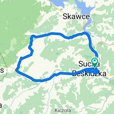
Sucha Beskidzka atr - Sucha Beskidzka
- -:--
- Duration
- 310.1 km
- Distance
- 2,198 m
- Ascent
- 2,207 m
- Descent
- ---
- Avg. speed
- ---
- Max. altitude

Route quality
Waytypes & surfaces along the route
Waytypes
Busy road
203.2 km
(66 %)
Road
26.9 km
(9 %)
Surfaces
Paved
207.3 km
(67 %)
Unpaved
11.9 km
(4 %)
Asphalt
195.9 km
(63 %)
Paving stones
8 km
(3 %)
Continue with Bikemap
Use, edit, or download this cycling route
You would like to ride Wokół Tatr or customize it for your own trip? Here is what you can do with this Bikemap route:
Free features
- Save this route as favorite or in collections
- Copy & plan your own version of this route
- Split it into stages to create a multi-day tour
- Sync your route with Garmin or Wahoo
Premium features
Free trial for 3 days, or one-time payment. More about Bikemap Premium.
- Navigate this route on iOS & Android
- Export a GPX / KML file of this route
- Create your custom printout (try it for free)
- Download this route for offline navigation
Discover more Premium features.
Get Bikemap PremiumFrom our community
Other popular routes starting in Sucha Beskidzka
 sucha Beskidzka
- Distance
- 20.9 km
- Ascent
- 561 m
- Descent
- 558 m
- Location
- Sucha Beskidzka, Lesser Poland Voivodeship, Poland
 Route to Stryszawa 23C, 34-205 Stryszawa
- Distance
- 188.9 km
- Ascent
- 4,420 m
- Descent
- 4,363 m
- Location
- Sucha Beskidzka, Lesser Poland Voivodeship, Poland
 Sucha Beskidzka - Wadowice (przez Leskowiec)
- Distance
- 32.6 km
- Ascent
- 682 m
- Descent
- 768 m
- Location
- Sucha Beskidzka, Lesser Poland Voivodeship, Poland
 Europa Tour 2k14 11 Sucha Beskidzka - Rownica
- Distance
- 186.8 km
- Ascent
- 2,058 m
- Descent
- 1,539 m
- Location
- Sucha Beskidzka, Lesser Poland Voivodeship, Poland
 Sucha Beskidzka - Magurka - Maków Podhalański
- Distance
- 31.8 km
- Ascent
- 663 m
- Descent
- 649 m
- Location
- Sucha Beskidzka, Lesser Poland Voivodeship, Poland
 30.08.2015
- Distance
- 129.6 km
- Ascent
- 1,073 m
- Descent
- 1,073 m
- Location
- Sucha Beskidzka, Lesser Poland Voivodeship, Poland
 Memorialem Henryka Łasaka
- Distance
- 33.1 km
- Ascent
- 361 m
- Descent
- 350 m
- Location
- Sucha Beskidzka, Lesser Poland Voivodeship, Poland
 Leskowiec z Suchej
- Distance
- 41 km
- Ascent
- 904 m
- Descent
- 902 m
- Location
- Sucha Beskidzka, Lesser Poland Voivodeship, Poland
Open it in the app