Dag 6 2015
- 137 km
- 2,098 m
- 2,595 m
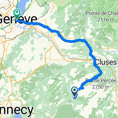
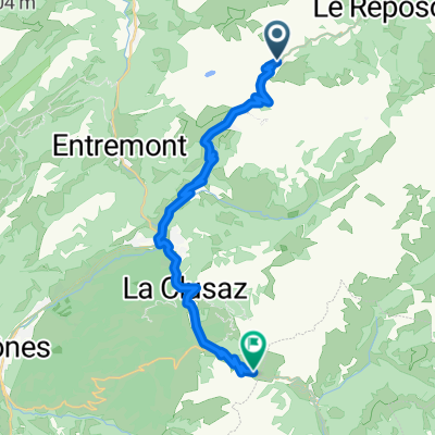
- Le Grand-Bornand, Auvergne-Rhône-Alpes, France
A cycling route starting in Le Grand-Bornand, Auvergne-Rhône-Alpes, France.
Overview
El Col de la Colombière es un paso de montaña ubicado en los Alpes franceses, en la región de Alta Saboya, en la comuna de Le Grand-Bornand. Este puerto se encuentra a una altitud de 1.613 metros sobre el nivel del mar y conecta los valles de Arve y Borne. Es un punto estratégico que une la ciudad de Cluses en el oeste con el valle de Arve y la localidad de Le Grand-Bornand en el este, sirviendo como un paso natural entre las montañas del macizo de Aravis.
created this 1 year ago
\"")
Route quality
Quiet road
0.5 km
(4 %)
Access road
0.1 km
(1 %)
Undefined
11.4 km
(95 %)
Paved
10.8 km
(90 %)
Asphalt
10.8 km
(90 %)
Undefined
1.2 km
(10 %)
Continue with Bikemap
You would like to ride COL DE LA COLOMBIÈRE (por Le Grand Bornand) or customize it for your own trip? Here is what you can do with this Bikemap route:
Free trial for 3 days, or one-time payment. More about Bikemap Premium.
Discover more Premium features.
Get Bikemap PremiumFrom our community
Open it in the app