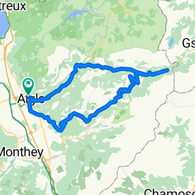
Etape 3 : Aigle - Gstaad (Tour de Suisse, Aramis) 40 km
- 39.7 km
- 1,192 m
- 601 m
- Aigle, Canton of Vaud, Switzerland
A cycling route starting in Aigle, Canton of Vaud, Switzerland.
Overview
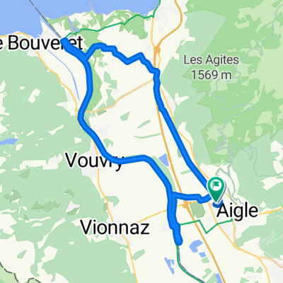
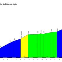
El Col du Pillon es un paso de montaña ubicado en los Alpes suizos, en el cantón de Vaud, en la región de los Alpes de Vaud, cerca de la frontera con el cantón de Berna. Este paso conecta la comuna de Les Diablerets, al norte, con la región de Gstaad, al sur. Se encuentra a una altitud de 1546 metros sobre el nivel del mar y es una de las rutas principales que unen los valles de Ormont-Dessus y Saanenland, ofreciendo un paso pintoresco y estratégico en los Alpes suizos. Esta zona es conocida por su impresionante paisaje alpino, con vistas a picos como el Oldenhorn y el Glacier 3000, que es un importante atractivo turístico en la región.
created this 1 year ago
\"")
Route quality
Quiet road
0.5 km
(2 %)
Track
0.5 km
(2 %)
Paved
17.6 km
(71 %)
Unpaved
0.5 km
(2 %)
Asphalt
17.6 km
(71 %)
Gravel
0.5 km
(2 %)
Undefined
6.7 km
(27 %)
Continue with Bikemap
You would like to ride COL DU PILLON (por Aigle) or customize it for your own trip? Here is what you can do with this Bikemap route:
Free trial for 3 days, or one-time payment. More about Bikemap Premium.
Discover more Premium features.
Get Bikemap PremiumFrom our community
Open it in the app