Torino Tour
A cycling route starting in Lesna, Piedmont, Italy.
Overview
About this route
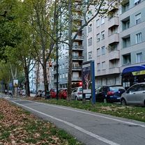
Starting from Piazza Rivoli, the idea is to plan a long ride without moving too much from the city. The track is partially hilly and partially flat. I think it can be good for long distance training without being too far from home.
Alternatives: in strarda borgaretto crossing Strada Torino is possible go straight and continue on the cycling path along Sangone river, instead of turning left to Strada Torino.
- -:--
- Duration
- 118.6 km
- Distance
- 1,265 m
- Ascent
- 1,264 m
- Descent
- ---
- Avg. speed
- 696 m
- Max. altitude
Route quality
Waytypes & surfaces along the route
Waytypes
Road
59.3 km
(50 %)
Quiet road
23.7 km
(20 %)
Surfaces
Paved
87.8 km
(74 %)
Asphalt
87.8 km
(74 %)
Undefined
30.8 km
(26 %)
Continue with Bikemap
Use, edit, or download this cycling route
You would like to ride Torino Tour or customize it for your own trip? Here is what you can do with this Bikemap route:
Free features
- Save this route as favorite or in collections
- Copy & plan your own version of this route
- Split it into stages to create a multi-day tour
- Sync your route with Garmin or Wahoo
Premium features
Free trial for 3 days, or one-time payment. More about Bikemap Premium.
- Navigate this route on iOS & Android
- Export a GPX / KML file of this route
- Create your custom printout (try it for free)
- Download this route for offline navigation
Discover more Premium features.
Get Bikemap PremiumFrom our community
Other popular routes starting in Lesna
- Almese - Tagliafuoco
- Distance
- 38 km
- Ascent
- 291 m
- Descent
- 255 m
- Location
- Lesna, Piedmont, Italy
- stupinigi, none, volvera, zucche
- Distance
- 45.6 km
- Ascent
- 63 m
- Descent
- 63 m
- Location
- Lesna, Piedmont, Italy
- Giro dei tre colli: Colletta di Giaveno - Colle Braida - Colle del Lys - Colle della Dieta
- Distance
- 155.8 km
- Ascent
- 2,400 m
- Descent
- 2,399 m
- Location
- Lesna, Piedmont, Italy
- Steady ride in Monte Musiné e laghi casellette
- Distance
- 38 km
- Ascent
- 668 m
- Descent
- 592 m
- Location
- Lesna, Piedmont, Italy
- Da Santa Rita al Valentino
- Distance
- 14.5 km
- Ascent
- 74 m
- Descent
- 108 m
- Location
- Lesna, Piedmont, Italy
- Torino ovest-Monte Cuneo
- Distance
- 46 km
- Ascent
- 707 m
- Descent
- 717 m
- Location
- Lesna, Piedmont, Italy
- Da Via Gradisca 57, Torino a Via Mombarcaro 21/B, Torino
- Distance
- 9 km
- Ascent
- 44 m
- Descent
- 89 m
- Location
- Lesna, Piedmont, Italy
- Giro a velocità lenta a monte dei cappuccini
- Distance
- 12.2 km
- Ascent
- 22 m
- Descent
- 95 m
- Location
- Lesna, Piedmont, Italy
Open it in the app