

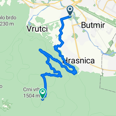
Sarajevo - Srebrenica
A cycling route starting in Sarajevo, Federation of Bosnia and Herzegovina, Bosnia and Herzegovina.
Overview
About this route
- -:--
- Duration
- 145.4 km
- Distance
- 1,442 m
- Ascent
- 1,711 m
- Descent
- ---
- Avg. speed
- ---
- Avg. speed
Route highlights
Points of interest along the route
Point of interest after 10.1 km
odmor
Point of interest after 28.3 km
odmor
Point of interest after 59.4 km
odmor
Point of interest after 64.9 km
ručak
Point of interest after 96.4 km
odmor
Point of interest after 119.5 km
odmor
Continue with Bikemap
Use, edit, or download this cycling route
You would like to ride Sarajevo - Srebrenica or customize it for your own trip? Here is what you can do with this Bikemap route:
Free features
- Save this route as favorite or in collections
- Copy & plan your own version of this route
- Split it into stages to create a multi-day tour
- Sync your route with Garmin or Wahoo
Premium features
Free trial for 3 days, or one-time payment. More about Bikemap Premium.
- Navigate this route on iOS & Android
- Export a GPX / KML file of this route
- Create your custom printout (try it for free)
- Download this route for offline navigation
Discover more Premium features.
Get Bikemap PremiumFrom our community
Other popular routes starting in Sarajevo
 lukavica>tvrdimići>jasik&>brus>bistrik kula
- Distance
- 45.3 km
- Ascent
- 1,519 m
- Descent
- 1,517 m
- Location
- Sarajevo, Federation of Bosnia and Herzegovina, Bosnia and Herzegovina
 Alpasino - Krupac - Dejcici - Trnovo - Dobrinja
- Distance
- 69.4 km
- Ascent
- 909 m
- Descent
- 919 m
- Location
- Sarajevo, Federation of Bosnia and Herzegovina, Bosnia and Herzegovina
 first alternative Sarajevo-milano
- Distance
- 1,264.6 km
- Ascent
- 2,281 m
- Descent
- 2,685 m
- Location
- Sarajevo, Federation of Bosnia and Herzegovina, Bosnia and Herzegovina
 Kotorac - Tranzit - Centar - Stari Grad - Pofalići - Rajlovac - Vrelo Bosne - Vojkovići - Kotorac
- Distance
- 47.2 km
- Ascent
- 324 m
- Descent
- 324 m
- Location
- Sarajevo, Federation of Bosnia and Herzegovina, Bosnia and Herzegovina
 Ive Andrića 17c to Ive Andrića 19j, Sarajevo
- Distance
- 35.8 km
- Ascent
- 181 m
- Descent
- 174 m
- Location
- Sarajevo, Federation of Bosnia and Herzegovina, Bosnia and Herzegovina
 MTB City Road
- Distance
- 14.6 km
- Ascent
- 270 m
- Descent
- 272 m
- Location
- Sarajevo, Federation of Bosnia and Herzegovina, Bosnia and Herzegovina
 h stan
- Distance
- 16.4 km
- Ascent
- 943 m
- Descent
- 131 m
- Location
- Sarajevo, Federation of Bosnia and Herzegovina, Bosnia and Herzegovina
 From Sarajevo to Visoko
- Distance
- 55.3 km
- Ascent
- 1,350 m
- Descent
- 1,441 m
- Location
- Sarajevo, Federation of Bosnia and Herzegovina, Bosnia and Herzegovina
Open it in the app