

Trofeo Luis Garcia Gapparrez
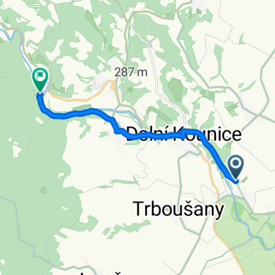
A cycling route starting in Dolní Kounice, South Moravian, Czechia.
Overview
About this route
<p><strong>Trofeo Luis Garcia Gapparrez</strong></p>
<p>(21.3. 2009)</p>
<p> </p>
<p>Pravlov City - Dolní Kounice - Hlína - Ivančice - Moravký Krumlov - Pohořelice - Pravlov City</p>
Translated, show original (Spanish)- -:--
- Duration
- 77.3 km
- Distance
- 868 m
- Ascent
- 854 m
- Descent
- ---
- Avg. speed
- 464 m
- Max. altitude

Route quality
Waytypes & surfaces along the route
Waytypes
Road
40.2 km
(52 %)
Track
1.5 km
(2 %)
Surfaces
Paved
27.8 km
(36 %)
Unpaved
1.5 km
(2 %)
Asphalt
27.8 km
(36 %)
Unpaved (undefined)
1.5 km
(2 %)
Undefined
48 km
(62 %)
Continue with Bikemap
Use, edit, or download this cycling route
You would like to ride Trofeo Luis Garcia Gapparrez or customize it for your own trip? Here is what you can do with this Bikemap route:
Free features
- Save this route as favorite or in collections
- Copy & plan your own version of this route
- Sync your route with Garmin or Wahoo
Premium features
Free trial for 3 days, or one-time payment. More about Bikemap Premium.
- Navigate this route on iOS & Android
- Export a GPX / KML file of this route
- Create your custom printout (try it for free)
- Download this route for offline navigation
Discover more Premium features.
Get Bikemap PremiumFrom our community
Other popular routes starting in Dolní Kounice
 Pravlov do Ivančice
- Distance
- 7.8 km
- Ascent
- 154 m
- Descent
- 141 m
- Location
- Dolní Kounice, South Moravian, Czechia
 Trofeo Ulrich von Lichtenstein - Tour de Pálava 2010
- Distance
- 134.1 km
- Ascent
- 424 m
- Descent
- 427 m
- Location
- Dolní Kounice, South Moravian, Czechia
 Moje
Moje- Distance
- 637.9 km
- Ascent
- 2,470 m
- Descent
- 2,662 m
- Location
- Dolní Kounice, South Moravian, Czechia
 Trofeo Luis Garcia Gapparrez
- Distance
- 77.3 km
- Ascent
- 868 m
- Descent
- 854 m
- Location
- Dolní Kounice, South Moravian, Czechia
 2012.08.24 - Silůvky-Vranovice - Tutorka
- Distance
- 21.6 km
- Ascent
- 40 m
- Descent
- 114 m
- Location
- Dolní Kounice, South Moravian, Czechia
 3. Templářská cyklotrasa 2012
- Distance
- 50 km
- Ascent
- 474 m
- Descent
- 454 m
- Location
- Dolní Kounice, South Moravian, Czechia
 muj okruh č.2
- Distance
- 63.3 km
- Ascent
- 123 m
- Descent
- 153 m
- Location
- Dolní Kounice, South Moravian, Czechia
 Zavod - siluvky
- Distance
- 95.7 km
- Ascent
- 610 m
- Descent
- 548 m
- Location
- Dolní Kounice, South Moravian, Czechia
Open it in the app