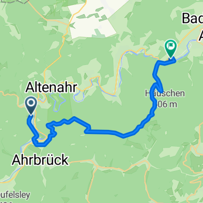
CYCLING THE RHINE: Route 10B(b)
A cycling route starting in Altenahr, Rhineland-Palatinate, Germany.
Overview
About this route
Route 10B(b): Return route from Altenahr Railway Station to Linz am Rhein Railway Station.
- -:--
- Duration
- 35.9 km
- Distance
- 84 m
- Ascent
- 195 m
- Descent
- ---
- Avg. speed
- ---
- Avg. speed
Route highlights
Points of interest along the route
Point of interest after 4.5 km
You can follow the marked cycle route by turning Right here - there is a tunnel section through the hill.
Point of interest after 5.9 km
Rejoin the marked cycle route from the longer roadway route here.
Accommodation after 15.9 km
YOUTH HOSTEL: DJH Ahrweiler St Piusstrasse 7, 53474 Bad Neuenahr- Ahrweiler
Point of interest after 29.6 km
At this point you join the outward route and follow it back to Linz am Rhein.
Point of interest after 32.3 km
If the cyclepaths ahead are impassable due to flooding, turn right here, continue straight up Bruhlsweg, turn left along Weidenweg, and continue until tou join this route a short distance along the road.
Point of interest after 32.9 km
Rejoin the route here if you diverted away from the riverside paths.
Continue with Bikemap
Use, edit, or download this cycling route
You would like to ride CYCLING THE RHINE: Route 10B(b) or customize it for your own trip? Here is what you can do with this Bikemap route:
Free features
- Save this route as favorite or in collections
- Copy & plan your own version of this route
- Sync your route with Garmin or Wahoo
Premium features
Free trial for 3 days, or one-time payment. More about Bikemap Premium.
- Navigate this route on iOS & Android
- Export a GPX / KML file of this route
- Create your custom printout (try it for free)
- Download this route for offline navigation
Discover more Premium features.
Get Bikemap PremiumFrom our community
Other popular routes starting in Altenahr
- RRR3 (Mittlere Runde Altenahr)
- Distance
- 71.1 km
- Ascent
- 1,160 m
- Descent
- 1,078 m
- Location
- Altenahr, Rhineland-Palatinate, Germany
- Ahrrunde zur Hohen Acht
- Distance
- 61.5 km
- Ascent
- 1,067 m
- Descent
- 951 m
- Location
- Altenahr, Rhineland-Palatinate, Germany
- Familienradtour in Coronazeiten
- Distance
- 32.6 km
- Ascent
- 331 m
- Descent
- 332 m
- Location
- Altenahr, Rhineland-Palatinate, Germany
- Testfahrt anl. der Winterwanderung der KfA 2018
- Distance
- 13.7 km
- Ascent
- 393 m
- Descent
- 394 m
- Location
- Altenahr, Rhineland-Palatinate, Germany
- Altenahr - Mönchengladbach
- Distance
- 103.9 km
- Ascent
- 288 m
- Descent
- 382 m
- Location
- Altenahr, Rhineland-Palatinate, Germany
- Altenburg - Steinerberg - Altenburg
- Distance
- 24 km
- Ascent
- 906 m
- Descent
- 906 m
- Location
- Altenahr, Rhineland-Palatinate, Germany
- EAR05_Altenahr-Bonn
- Distance
- 53.3 km
- Ascent
- 32 m
- Descent
- 137 m
- Location
- Altenahr, Rhineland-Palatinate, Germany
- Gerade Fahrt in Altenahr
- Distance
- 28.6 km
- Ascent
- 778 m
- Descent
- 778 m
- Location
- Altenahr, Rhineland-Palatinate, Germany
Open it in the app